Sunday, 4 December 2016

Pacific Ring Of Fire

Pacific Ring Of Fire

Pacific Ring Of Fire Facts


The Pacific Ring of Fire is the name that is given to a horseshoe shaped area in the Pacific Ocean which extends from South America and North America to Eastern Asia, Australia and New Zealand. This area is famous for its constant seismic activity and because of the amount of active volcanoes that can be found here. 75% of dormant and active volcanoes are found in the Pacific Ring of Fire. Now it is known that the area is very close to several tectonic plates which may be what influences the violent activity in the area.

Volcanoes In The Area

It is believed that the Pacific Ring of Fire has a total of 452 volcanoes. Some of the world’s most active volcanoes are found here. Kilauea which is considered the most active volcano in the world is located in the Pacific Ring of Fire. Other volcanoes worth noting are Mt Fuji in Japan, Mt. Saint Helens and Mt. Rainier in the American North West, Krakatoa in Indonesia, Mauna Loa in Hawaii, Galeras in Colombia and Sangay in Ecuador. Those are all volcanoes that are well known and some that could be very dangerous to the population nearby.

Most Dangerous Volcanoes

Because of all the activity in the Pacific Ring of Fire it is very possible that one of those volcanoes could cause a lot of trouble for a lot of people. If Mt Rainier were to erupt for example the 2.5 million people in the area near Seattle and Tacoma would have to evacuate fast. Adding to the danger is the snowy cap of the volcano which could make the dangers much worse.


The Santa Maria Volcano in Guatemala has already shown its power with one of the most catastrophic eruptions in the 20th century taking place in 1902. Back then the volcano affected a very large part of the south west of the country; today with many more people in the area the impact of this volcano in the Pacific Ring of Fire could be much greater.
Mount Yasur in Vanuatu is what’s called a stratovolcano and it has been erupting for close to a hundred years. The dangers that Mount Yasur presents are real, and yet tourists risk the dangers of toxic gases and lava flows by getting to the crater every day. This volcano has already taking a few lives from tourists and a tour guide who got too close to the danger zone.

Constant Changes

The Pacific Ring of Fire is different today than it was thousands of years ago because of the changes caused by tectonic plates. The Pacific Plate will hit other plates nearby and that causes them to sink. The crust melts producing the magma that feeds the different volcanoes in the Pacific Ring of Fire or it will help produce new volcanoes. The tectonic plates are also the reason for the many violent earthquakes in the entire area of the pacific.

Risks

If you are in a city that is located in the Pacific Ring of Fire then you already know that there are several risk factors that you have to be ready for. Close to 90 percent of the earthquakes reported around the world take place in the Ring of Fire. Add to that the possibility of volcano eruptions and that can really be a dangerous area to live in. People not only have to look at the active volcanoes as the dormant ones also pose a threat. Mt. Saint Helens was a dormant volcano before its eruption in 1980 which caused several deaths and over a billion dollars in damage.


Thunderstorm

 Thunderstorm 

What Is A Thunderstorm?


Thunderstorms are some of the most frightening and powerful storms to hit the world.  A thunderstorm can be known as a lightning storm, a thundershower or even an electrical storm.  A thunderstorm is one of the most powerful storms to hit and it forms when the weather is turbulent.  This is when the wind picks up greatly and rain is present, though this doesn’t always need to be present.  However, lightning and the noise of thunder creates the thunderstorms and if there are certain types of clouds in the sky – cumulonimbus, then it could result in thunderstorms.
On most occasions, thunderstorms will bring on heavy rain falls and strong winds.  However, these are the most common types of weather associated with thunderstorms but there are other types of weather that can accompany a thunderstorm.  Things such as hail, sleet and snow are all common factors to present itself during a thunderstorm.  Some thunderstorms can rotate, if they are quite severe, then they can create supercells which are some of the worst thunderstorms.

How Thunderstorms Are Are Created?

A thunderstorm can be created because of a sharp or rapid surge of moist and warm air.  However, as the warm and moist air moves upwards into the air, it will cool down and condenses.  When the air does this, the air will form new cumulonimbus clouds.  These cumulonimbus clouds can in fact reach huge heights of almost 20 kilometres, sometimes much more than that.
Once the air reaches a certain point, at the dew point, ice and water droplets are going to form and start falling towards the earth and the earth’s surface.  It falls from a large distance; however, once the droplets fall, they will be larger because they join up with other droplets.  Once the droplets are falling, they will create a new downdraft of the air which will spread out vastly across the surface.  This creates winds – strong winds which coincide with thunderstorms.
  • Hail
  • Rain
  • Strong Winds
  • Snow
  • Sleet
These are some of the things to spot when it comes to thunderstorms.
Electrical storm facts
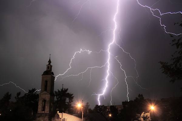
Lightning and church

Where Can Thunderstorm Form?

A thunderstorm can be formed or created in almost any location around the world.  Though, the countries that are mid latitude – this is when the air is moist and warm but comes into contact with cool air.  Thunderstorms can form anywhere if the air is warm and moist and comes into cooler air.  Though, most thunderstorms can be very severe and can cause a lot of damage to landscapes and populated areas also.
Though, most damage that comes from a thunderstorm is due to the larger hailstones which fall with the storm and the down burst winds.  Though, on occasion, there have been flash floods to cause a lot of damage.  Though, with some thunderstorm formations, they can be very strong or – super cells as they can also be known as, and cause water sprouts and even tornadoes.  There are some instances which are not going to be too severe and won’t be anything more than a small rain shower.  Some thunderstorm cells which are stronger than average storms can be fifty times the energy of an a bomb.

The Different Types of Thunderstorms

There are however four different types of thunderstorms including;
  1. Supercells which are the most powerful thunderstorms available
  2. A single cell which are smaller and not too severe
  3. A multi cell cluster which is stronger than a single cell storm
  4. Multi cell lines which are just below a super cell
The super cells are the strongest of thunderstorms that form; and if the thunderstorms are present in the tropics, it could contribute to hurricanes.  However, there are also dry thunderstorms which don’t cause any rain, hail or snow fall, but they can cause wildfire outbreaks.  This happens because of the lightning that occurs; there might not be any hail or rain but lightning still occurs and causes wildfires.
Many weather observers use things such as weather stations and weather radar to help keep a close eye over pending weather storms including thunder.  Interesting though, it has been known for some thunderstorms, can be created on both Venus and Jupiter and not just here on Earth.

The Cycle of a Thunderstorm

The cycle of a thunderstorm firstly starts off with warm air.  The warm air needs to have a lower density than cooler air because the air will start to rise actually within the cool air.  When this happens, clouds will start to form and they will become a little warmer because inside the clouds, it will now carry moisture.
The moisture will condense and when it does, it will release energy out; however, what this does is to cool the air of the condensed air but the surrounding air will stay the same.  If there is instability in the atmosphere then it will create cumulonimbus clouds and that helps to create thunder and lightning.  However, for thunderstorms to form, they need moisture, unstable air mass and a lifting force such as heat to create a thunderstorm.
There are different stages to create a thunderstorm.  There is the developing stage, then the mature stag and finally the dissipation stage.  Though, the thunderstorms can vary from size but for the average storm, it is around 24 kilometres.  The period of time in which the thunderstorms can develop is anything from thirty minutes.

Thunderstorm facts and information
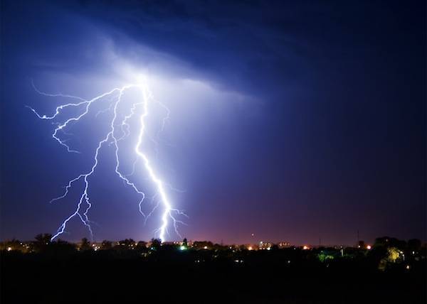
Thundershower, electrical storm or thunderstorm.

When the thunderstorm hits the cumulus stage, or the developing stage; a mass of moisture will be taken up towards the atmosphere.  When the moisture goes into the air, the wind will be forced upwards into the atmosphere and will help to develop the thunderstorm.  However, the moisture will start cooling and this will form water drops because of the cool temperatures at a high altitude.
With the mature stage, the air which is now warm will rise further up and will continue to do so until it cannot rise any further and the air becomes at its warmest point.  When it reaches this point, the air will be forced out a vast area and will start to create an anvil shape creating the cumulonimbus clouds.  The water drops will then start to grow larger because they will join up with one another.  They will now be heavier and larger and will start to freeze into ice particles.  Though, as the ice falls, it will become, or rather melt, into rain.
With the final or dissipating stage, the thunderstorm is created.  A downdraft will work up and hit the ground quickly and spread out vastly also.  This can be known as a downburst and the cool air will then cut the inflow and stop the thunderstorm also.  The thunderstorm will dissipate.
The super cell storms are the biggest and the most severe storms to hit.  This is when the super cell storms have different up and down drafts causing the super cell.  It can stretch out to a vast area and can cause a lot of devastation and damage.  When the super cells are created, it will mean that the storms will be accompanied with severe weather.

Indian Ocean

 Indian Ocean

The Indian Ocean is the third largest, after the Atlantic and the Pacific Oceans. It extends over approximately 9,978 kilometers from southern Africa to Western Australia and is almost six times the size of the United States. Its boundaries include Asia in the north, Africa in the west, Australia in the east, and the Antarctic or the Southern Ocean in the south.

This body of water covers about 19.5 percent of the total water on Earth, or in other words, one-fifth. It covers 13.8 percent of the Earth’s surface. It has an area of 70.56 million square kilometers and includes:
– the Andaman Sea,
– The Arabian Sea,
– the Bay of Bengal,
– the Flores Sea,
– the Great Australian Bight,
– the Gulf of Aden,
– the Gulf of Oman,
– the Java Sea,
– the Mozambique channel,
– the Persian Gulf,
– the Red Sea,
– the Savu Sea,
– the Strait of Malacca, and
– The Timor Sea.

It connects with the Mediterranean Sea through the Suez Canal.
Its volume is 292,131,000 cubic kilometers. Its average depth is around 3,890 meters, and its deepest point is the Java Trench or Sunda Trench, measuring between 7,258 and 7,725 meters. However, sometimes it is mentioned that the Diamantina Trench is the deepest part of this ocean, slightly deeper, about 8,047 meters.
The highest level of salinity is in the Arabian Sea and along a belt of water.

Properties of the Indian Ocean.

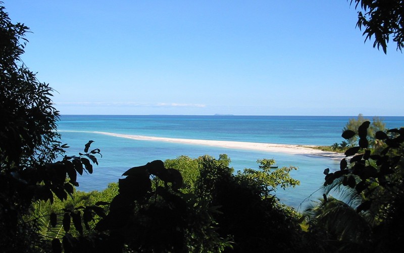
Madagascar. Waters of Indian Ocean.

The water salinity in the Indian Ocean is between 3.2 and 3.7 percent. The highest level of salinity is in the Arabian Sea and along a belt of water located between southern Africa and southwestern Australia. It is common to see icebergs at latitude 65° south throughout the year, but their limit is latitude 45° south.
Its surface temperature at latitude 20° south is about 22°C, while in the east can exceed 28°C. From latitude 40° south, water temperatures decrease. Incoming flows from the Atlantic Ocean, the Red Sea, and Antarctic currents control the circulation of water, but the ocean has two basic flow patterns: the northern hemisphere current, which moves to the right, and another stream south of the equator, which moves in the opposite direction.
The weather is variable. North of the equator, it is dominated by a monsoon climate, but in the southern hemisphere, winds are weaker, with occasional summer storms that hit the Mauritius Island. From October to April, there are high winds in the Northeast. The monsoon season causes cyclones that can batter the Bay of Bengal and the Arabian Sea.

This ocean is more recent than the others, so there are crags and ridges in its floor. The South Kerguelen Plateau, a small underwater continent of volcanic origin, is in the south. In the west and near Madagascar, there is an underwater plateau whose length is 2,000 kilometers.

Economic Importance of the Indian Ocean.

The Indian Ocean contains a significant amount of oil and natural gas and is also a source of fish, sand, and metal, relevant to different industries. It has four main waterways: Bab-el-Mandeb, the Strait of Hormuz, the Straits of Malacca, and the Suez Canal.

40 percent of the world’s offshore oil production has its origin in the Indian Ocean.
Marine life is relatively limited in the Indian Ocean due to lower concentrations of phytoplankton. However, the northern part of this ocean is home to a larger number of species, which are essential for human consumption. Fishing fleets from Russia, Japan, Taiwan and South Korea navigate this ocean catching shrimp and tuna.
Moreover, there is a continuous traffic carrying oil from Indonesia and the Persian Gulf, with an average of 17 million barrels of oil per day. In fact, 40 percent of the world’s offshore oil production has its origin in the Indian Ocean.

Conservation of the Indian Ocean.

In the late 90’s, a huge quantity of trash was found, suspended on the surface of the Indian Ocean. Thousands of plastic particles, chemical substances, and other garbage are concentrated there, covering about 10 million square kilometers. Meanwhile, the Arabian and Red Seas and the Persian Gulf are contaminated with hydrocarbons from oil and gas.
The ocean is home to some endangered species: the dugong, whales, seals, and turtles.

Quick facts:
• It is the warmest ocean basin on Earth.
• Annually, more than 7,000 humpback whales travel to the waters of Madagascar to breed and give birth.
• The world’s earliest civilizations developed around the Indian Ocean.
• In Sanskrit literature, it is known as “Ratnakara” which means “gemstone mine.”

Friday, 2 December 2016

Deforestation spikes in Brazilian Amazon

Illegal land clearing hits highest levels since 2008 as environmental policies come under attack.


Illegal deforestation in the Brazilian Amazon has spiked since 2015, bringing the rate to its highest level in 8 years. The finding has raised fears that the country could lose a decade’s worth of progress in forest protection.
In an analysis of satellite data released on 29 November, Brazil’s National Institute for Space Research (INPE) in São José dos Campos estimates that 7,989 square kilometres of land — nearly the size of Puerto Rico — was cleared between August 2015 and July 2016. The total was 29% above the previous year and 75% above the 2012 level, when deforestation hit a historic low of 4,571 square kilometres
The current trends illustrate a growing sense of impunity as well as betrayal among landowners who have yet to benefit from the sustainable-development agenda, says Daniel Nepstad, a tropical ecologist who heads the Earth Innovation Institute, an environmental organization in San Francisco, California. “There’s been a lot of talk about improving the lives and the bottom lines of farmers and ranchers if they stop clearing the forest,” Nepstad says, “and they are still waiting.”
Brazil basked in the international limelight for nearly a decade after deforestation began to drop in 2005, thanks in part to stronger government enforcement as well as high-profile commitments to halt deforestation by the beef and soya-bean industries. But the government’s success sparked a political backlash. The Brazilian Congress relaxed the country’s forest protections in 2012, and many Brazilian lawmakers are pushing to further relax environmental laws to promote development across the Amazon.
Meanwhile, the country has been rocked by economic recession and ongoing political-corruption scandals. This has diverted both money and attention away from environmental enforcement, emboldening ranchers and illegal land traders to resume clearing land, says Paulo Barreto, a senior researcher at the Amazon Institute of People and the Environment, an activist group in Belém.
Barreto notes that beef prices have risen, as has the size of the forest tracts that are being cleared — a sign that the major players are investing in illegal deforestation. With the Brazilian government as weak as it is, Barreto says that he hopes the beef industry in particular will bolster its efforts to prevent the sale of cattle from newly cleared land.
This would be an act of self-interest, he adds, because the industry's public image, at home and abroad, depends on Brazil's continued success in protecting the Amazon. “In the end, this is bad for Brazil, not only in environmental terms but also in terms of agricultural markets.”
 

Take on Nature: Roots of the robin's close ties with festive season 

Take on Nature: Roots of the robin's close ties with festive season  

AS WE enter December or decem, Latin for 10, originally the tenth month of the Roman calendar, our thoughts inevitably turn to Christmas.
As with many religious festivals, elements of the natural world are woven into the celebrations. Our much loved robin (Erithacus rubecula) is a bird historically associated with the birth of Jesus and adorns many cards featuring winter scenes as well as frequently forming part of the Christmas decorations.
There are many reasons for its close ties with the festive season. The robin is one of the few birds to sing right through the darkest days of winter and can be heard releasing its plaintive notes from leafless boughs when most other birdsong is absent, something 18th century poet William Cowper catches perfectly when writing of a robin he encountered on a winter's walk:
No noise is here, or none that hinders thought.
The redbreast warbles still, but is content
With slender notes, and more than half suppressed
It is, however, stories linking the robin with Christ and of exploits with saints which best explains its Christmas ties. Legend says the robin acquired its red breast through splashes of blood from Jesus while on the cross as it tried to stem the blood flow caused by the crown of thorns. Another version attributes the red breast to the blood from Christ's side as the robin tried to staunch the wound made by the legionary's lance.
Tales also say the robin kept the fire alight for the baby Jesus in the stable, by flapping its wings to keep air circulating. In counties Kerry and Clare it has the Irish name ‘spideog Mhuire' – Mary's robin – because it came to Mary's aid while fleeing to Egypt to escape Herod. As Mary ran she was cut by thorns and brambles, causing her to bleed, but the robin followed, covering all the blood with leaves and debris, to leave no trace.
A 12th century story recounts Scottish saint St Kentigern's links with the robin. As a boy, the saint was disliked at school by his peers because he was loved by their teacher Serf, who had a robin, which he fed daily. One day when Serf was out, the other boys decided they would indulge in play with the robin and as they handled it roughly and tried to snatch it from each other, the bird died in their hands.
They blamed Kentigern, who was not involved in the mischief. When Kentigern heard this, he took the dead robin in his hands and making the sign of the cross over it, said: ‘O Lord Jesus, give back to this little bird the breath of life'. Immediately the robin was restored to life and flew to meet his friend Serf.
Interestingly, much of our knowledge about the behaviour and habits of this universally popular bird is due to the pioneering work carried out by a Co Fermanagh-based civil engineer, James Parsons Burkitt.
Born in Killybegs, Co Donegal, Burkitt was also an experienced field ornithologist who designed and conducted the first population study of a bird, the robin, based on ringing individuals in his garden near Enniskillen in the early 1920s. His work was to prove highly significant as it enabled individual birds to be identified in the field and details of their territorial behaviour, song and threat display recorded.
He proved the longevity of one female robin which he had ringed on December 18 1927 and which he trapped again on July 14 1938 – making it at least 11 years old – "the oldest living robin in the world'' at the time.


Thursday, 1 December 2016

Famous Volcanoes Overview


Famous Volcanoes Overview 

Volcanoes are one of the most awesome natural events that the world can ever see, and they are also among the most dangerous. Currently there are approximately 1500 active volcanoes in the world but an active volcano can be described as one that has had an eruption at least within the last ten thousand years. There are many volcanoes that have been dormant for a lot longer than that and yet they could be some of the most dangerous if they were ever to explode. There are volcanoes in most of the world and some you would not be able to see even if you were standing on them even though they are some of the most famous volcanoes. Some areas are more active than others, but the most famous one is the Pacific Ring of Fire.

The Ring Of Fire

The Pacific Ring of Fire is the area in the Pacific Ocean, which has the most active volcanoes in the world. By the latest calculations over 75% of the active volcanoes in the world are located here. Because of that, you will find some of the world’s most famous volcanoes in that area. The area extends from the Chilean coast in South America to Alaska, to the East Coast of the Asian continent, down to Australia, New Zealand, and the Pacific Islands. There are a total of 452 known volcanoes in the Pacific Ring of Fire which is also known for the severity of its earthquakes.

Most Famous Volcanoes In The Ring Of Fire

Because of the amount of volcano activity in the Ring of Fire, some of the world’s most famous volcanoes can be found here. Some of the names you may recognize right away are Mount Saint Helens in Washington State, Kilauea in Hawaii, Mount Yasur in Vanuatu, Santa Maria in Guatemala, and Sangay in Ecuador all of which are still very much active. Another couple of recognizable names in the Ring of Fire are Mount Fuji in Japan, and Mauna Loa in Hawaii.

World’s Most Active Volcanoes

One thing that is important to note is that most of the famous volcanoes are also the most active in the world. Kilauea in Japan is one of the world’s most active volcano at the moment with its last spew of lava happened in 2011. The Nyamuragira volcano in the Democratic Republic of Congo is the most active volcano in Africa and it has erupted at the very least 34 times since 1882. Mount Etna, which was believed by ancient Romans to be the home of the god of fire Vulcan has a continuous history of eruptions that dates back over 3500 years. Piton de la Fournaise or Le Volcan as it is known to locals at Reunion Island has seen over 150 eruptions since the records show it in the 17th century.

What Happens When A Volcano Erupts

To understand famous volcanoes and even volcanoes in general it is important to understand eruptions. Before an eruption takes place there is a lot of commotion beneath the surface which involves melted rock. The substance that is created during that commotion is what is later spilled while the eruption takes place. The name of the molten lava that will flow down the side of a volcano is what is known as magma, but before the magma is expelled out it needs to rise and that is created by disturbances of low and high pressures.
The eruption does not have to be the big explosion that people associate with famous volcanoes. There are mild eruptions, which only cause steam blasts. Others are still considered mild but will have lava run down de side of the volcano and ejected ash or rock fragments. There are however more dangerous and stronger eruptions which can cause a lot of damage to the surrounding area. A Vulcanian explosion will contain solidified rock, which will produce a pyroclastic flow.

Volcanoes With The Potential Of Being The Deadliest

Some of the world’s most famous volcanoes have destroyed entire cities and killed everyone in the nearby area. Mount Vesuvius for example destroyed the entire city of Pompey and archeological records show the devastation it caused. There are some volcanoes that could cause the same type of damage to cities today with the difference that the population around those volcanoes is even larger than that of ancient Pompeii.
The city of Kagoshima in Japan has 680,000 people and the Sakurajima volcano located nearby has been experiencing small explosions since 1955. Catania near Mount Etna has 300,000 people in the area, which has seen the dangers of Mount Etna when an eruption destroyed some of its structures in the 1600’s. The 450,000 people in Pasto Colombia have been on guard due to the Galeras Volcano nearby. In 2005 then were forced to wear goggles and facemasks because of an explosion. Seattle’s population of 608,000 live in that shadows of Mount Rainier and though the volcano is quiet for now, its past history is anything but. Finally, close to a million people live in Naples, Italy. Their biggest and scariest neighbor is Mount Vesuvius, which has destroyed an entire city and the surrounding areas in the past. These are just some of the famous volcanoes near people, but there are a lot more.

Super Volcanoes

If the most famous volcanoes listed before were to erupt, they could cause a lot of destruction, but that destruction would be nowhere near to what would happen if a super volcano were to erupt. There are several of these volcanoes and they have caused severe destruction in the past. Their eruptions are measured using the Volcano Eruption index or VEI. The most severe eruptions are those that reach the VEI8 classification and there have been 10 of those eruptions in recorded history, 5 of which were in the US.

What Would Happen If A Super Volcano Erupted Today?

If a super volcano like the one found at Yellowstone Park in the US were to erupt today it would instantly be a famous volcano, but there would not be as many people to tell the story. The last time that the Yellowstone volcano erupted was 640,000 years ago and it is believed that it was the main cause of the latest ice age. If an eruption of that magnitude were to happen today the people nearby would stand no chance as they would be hit by 500 degree lava. Even if the lava does not reach you the ash would and that would cause you to choke to death as you inhale it.
People in other parts of the world would not get away unharmed because the global temperatures would drop by a minimum of 21 degrees. That would cause plant life and animal life to die off, leaving the people in the rest of the world without food and very cold. In other words, the great majority of people would starve.
The problem is that some scientists believe that the volcano at Yellowstone Park erupts once every 600,000 years, and if that is the case then we are overdue. No one knows when one of these famous volcanoes will erupt, but when they do it will be a spectacle that could end life as we know it.

Super volcano 

Supervolcano

Volcanoes can be both very impressive and highly destructive. While most people are used to watching the big shows of lava spewing from volcanoes on TV and some while volcano watching during their vacations, no one can possibly be prepared to the amount of disaster that a supervolcano would cause. In recorded history no one has experienced the fury of a supervolcano first hand but it is believed the impact that such an eruption could have would be deadly not only to people in the vicinity, but even for people on the other side of the world.

Known Supervolcanoes (Yellowstone)

There are six supervolcanoes which are currently known by most people. The many visitors of Yellowstone Park may not realize it, but they are walking on top of one of the biggest threats to humanity.  To understand how massive an eruption from one of these volcanoes can be, we can look at what took place in the Yellowstone Caldera volcano that erupted 2 million years ago. The size of the eruption was so big that the amount of ash ejected was over 8,000 times the amount ejected by the 1980 eruption of Mount St. Helens.

Long Valley Caldera

The Long Valley Caldera is located in the eastern side of the state of California and it is second only to Yellowstone. It’s last eruption, though not as massive as the one in Yellowstone supervolcano could still cause tremendous damage to the population in the world; that eruption took place close to 760,000 years ago, and the result was 2,000 times the size of the eruption of Mount St Helens.

Valles Caldera

The Valles Caldera is located northern of New Mexico and its last supervolcano eruption happened over a 50,000 years ago. The effects of the supervolcano eruption at the Valles Caldera were felt as far as Iowa as some ash and rock landed all the way there.

Lake Toba

Lake Toba in Indonesia is big; in fact it is actually bigger than the Yellowstone caldera. The last time this supervolcano erupted was 74,000 years ago.  The eruption that was presented was 5,000 times larger than the Mount St. Helens eruption and it has been suggested by several scientists that this event was so massive that it changed the trajectory of humanity and resulted in what we see today.

Taupo Caldera

The Taupo Caldera is located in New Zealand and though now the view that you get is that s a spectacular lake, that lake was created by an eruption 26,500 years ago; the basin which was left after the eruption is what became the lake you see today. This massive monster is not a dead supervolcano. Volcanic activity can be observed in the area in the form of venting and hot springs.

Aira Caldera

This Caldera in Japan is pretty close to the city of Kagoshima. This is not a sleeping giant; in fact there are several earthquakes in the area caused by it and the Sakura-jima volcano is still active. Those are clear signs that the caldera is still active and it is a reason for concern for scientists.