Friday 30 September 2016

Nature Conservancy preserving Brazoria ecological haven thanks to unlikely ally

The Nature Conservancy advocates and staff walk by a large tree in a the Columbia bottomlands in Brazoria County Tuesday, Sept., 20, 2016  The Nature Conservancy has gotten a $14 million donation from an Australian company to purchase ecologically valuable land in Texas and Arkansas. Here, the money will go to preserve the Columbia bottomlands in Brazoria County which is primo bird habitat. Photo: Steve Gonzales, Houston Chronicle / © 2016 Houston Chronicle


WEST COLUMBIA - The Columbia Bottomlands is an ecological gem.

It is the place in Southeast Texas where the salty coast gives way to a hardwood forest. Monarch butterflies pass through here in the spring and fall and millions of migratory songbirds use it as resting place, after their long journey across the Gulf of Mexico. It is also disappearing as growth from the Houston area pushes outward.


But on Thursday The Nature Conservancy announced it had purchased 1,900 acres in the Columbia Bottomlands in Brazoria County as a result of a $14 million donation from Australia-based BHP Billiton, the world's largest mining company. Of that amount, $8 million will go to establish two nature preserves in Brazoria County, and $6 million will be used to buy land in Arkansas. It is the largest private donation the group ever has received to buy land in Texas.

The Nature Conservancy seized the chance to buy the property, which sits in the heart of the Columbia Bottomlands, right between the Brazos and San Bernard Rivers.


If you need more evidence that this is a ecologically valuable piece of property, there it is," said Jeff Weigel of The Nature Conservancy of Texas, nodding to a Monarch butterfly perched on a milkweed growing at the group's new Brazos Woods Preserve. "It truly has it all."

Indeed, the whole area is considered a nature lover's paradise. Visitors flock there each year to witness exhausted migrating birds resting in the forest canopy.

The area is of such importance to wildlife that the U.S. Fish and Wildlife Service is seeking to protect 70,000 acres there and has recently joined forces with The Nature Conservancy to accomplish that goal.


It won't be easy. Of the original 700,000 acres of forest, only 147,000 acres remains today. The forest began to vanish when farming took hold in the region decades ago, a trend that has only continued to worsen as Houston's population exploded and began pushing out to the exurbs.


Protecting the land from development will improve water quality for the whole region, save habitat for fish and wildlife and increase opportunities to educate urban children about the value of nature, said Laura Huffman, Texas state director of the Nature Conservancy.


When the Nature Conservancy sees the opportunity to help protect a fragmented landscape, we swing into action," she said. "But we realize that we can't get the job done by ourselves and need both private and public partners. This is an area that deserves all of our attention."


Connecting the islands

Almost 50 years ago, Congress recognized the importance of the Columbia Bottomlands by establishing the San Bernard National Wildlife Refuge.


The refuge is a birding paradise - migratory songbirds such as warblers and orioles spend their winters there as do ducks and other waterfowl. U.S. Fish and Wildlife Service officials say they realized long ago that protecting the refuge means protecting the land that surrounds it. So the agency began acquiring property in the area with the goal to conserve 70,000 acres in the Columbia Bottomlands, roughly 10 percent of its historical expanse.


"As we start thinking about development in the urban areas, it makes every piece of property even more critical," said Benjamin Tuggle, head of the fish and wildlife agency's regional office that oversees Texas. "That's why we can't think of these as islands that function independently because the impact would be overwhelming. There needs to be connections."


Enter the Nature Conservancy of Texas, an Austin-based nonprofit that focuses on conserving land and water. The group had been approached about four years ago by BHP Billiton about the prospect of making a donation for land conservation.

In some ways, it was an easy choice.

nce of BHP officials. And the land also was relatively close to the Nature Conservancy's Nash Prairie Preserve, one of the last intact pieces of coastal prairie in the Houston area.

"We're trying to get 70,000 acres in this archipelago of land," said Weigel who heads strategic initiatives for the conservancy in Texas. "And we try, because the science tells us to, to lock up the biggest pieces of land for the greatest ecological benefit."

An unlikely ally


At first blush, an Australian mining and oil company might seem like an odd choice to step up to save a swampy plot of forest land in Southeast Texas.

BHP Billiton officials, however, said they wanted to make a donation that would benefit land conservation in a state where they worked. BHP is drilling in two Texas fields - the Permian Basin and the Eagle Ford Shale.


"We went to the Nature Conservancy and asked 'What are the best areas we can conserve?' '' said Ed Mongan, BHP's senior manager for the environment. "They said this is a really special area that has a lot of things that are worth preserving."


Since 2001, the company has donated more than $2 billion to community projects worldwide.


But the company's global philanthropy recently has been overshadowed by a dam collapse that occurred in Brazil in 2015 that killed 19 people, destroyed several villages and polluted a river with waste from its Samarco mine. The event is widely considered one of Brazil's worst environmental disasters.


The catastrophe happened more than two years after the company initially approached the conservancy about the donation to the Texas and Arkansas land preservation projects, a fact company officials pointed to when asked if the gift was an example of corporate "greenwashing."

Nature Conservancy officials don't see it that way, either.


Huffman said given the demand for land in Texas, there's almost no way the group can procure property without the help of corporate partners like BHP.

The money will help pay some forest restoration and for both new preserves. Native trees will be replanted where needed and invasive plant species like Chinese tallow and water hyacinth removed if possible.


At the Brazos Woods Preserve, there are plans to build an outdoor pavilion, which will function as a gathering place and an outdoor classroom of sorts. The conservancy also recently erected a webcam near a nest visited by eagles every year.

"As people become less and less connected to nature, it becomes more important to have opportunities to take classrooms outdoors and show them what it looks like," Huffman said. "Houston was built on a prairie and there are still some places like this you can get a feel for what it used to be like."


Sunday 25 September 2016

Deforestation

Here's what you need to know about ​the warming planet, ho​​w it's affecting us, and what's at stake.
<p>Photo: Deforestation area in Panama City's Rio Chagres basin</p>
Photograph by Tomas Munita/AP Photos


Modern-Day Plague

Deforestation is clearing Earth's forests on a massive scale, often resulting in damage to the quality of the land. Forests still cover about 30 percent of the world’s land area, but swaths the size of Panama are lost each and every year.

The world’s rain forests could completely vanish in a hundred years at the current rate of deforestation.

Forests are cut down for many reasons, but most of them are related to money or to people’s need to provide for their families.The biggest driver of deforestation is agriculture. Farmers cut forests to provide more room for planting crops or grazing livestock. Often many small farmers will each clear a few acres to feed their families by cutting down trees and burning them in a process known as “slash and burn” agriculture.

Logging operations, which provide the world’s wood and paper products, also cut countless trees each year. Loggers, some of them acting illegally, also build roads to access more and more remote forests—which leads to further deforestation. Forests are also cut as a result of growing urban sprawl.

Not all deforestation is intentional. Some is caused by a combination of human and natural factors like wildfires and subsequent overgrazing, which may prevent the growth of young trees.

Deforestation has many negative effects on the environment. The most dramatic impact is a loss of habitat for millions of species. Seventy percent of Earth’s land animals and plants live in forests, and many cannot survive the deforestation that destroys their homes.

Deforestation also drives climate change. Forest soils are moist, but without protection from sun-blocking tree cover they quickly dry out. Trees also help perpetuate the water cycle by returning water vapor back into the atmosphere. Without trees to fill these roles, many former forest lands can quickly become barren deserts.

Removing trees deprives the forest of portions of its canopy, which blocks the sun’s rays during the day and holds in heat at night. This disruption leads to more extreme temperatures swings that can be harmful to plants and animals.

Trees also play a critical role in absorbing the greenhouse gases that fuel global warming. Fewer forests means larger amounts of greenhouse gases entering the atmosphere—and increased speed and severity of global warming.

The quickest solution to deforestation would be to simply stop cutting down trees. Though deforestation rates have slowed a bit in recent years, financial realities make this unlikely to occur.

A more workable solution is to carefully manage forest resources by eliminating clear-cutting to make sure that forest environments remain intact. The cutting that does occur should be balanced by the planting of enough young trees to replace the older ones felled in any given forest. The number of new tree plantations is growing each year, but their total still equals a tiny fraction of the Earth’s forested land.

Friday 23 September 2016

Global Warming


What is Global Warming?


Global Warming is the increase of Earth's average surface temperature due to effect of greenhouse gases, such as carbon dioxide emissions from burning fossil fuels or from deforestation, which trap heat that would otherwise escape from Earth. This is a type of greenhouse effect.


Is global warming, caused by human activity, even remotely plausible?


Earth's climate is mostly influenced by the first 6 miles or so of the atmosphere which contains most of the matter making up the atmosphere. This is really a very thin layer if you think about it. In the book The End of Nature, author Bill McKibbin tells of walking three miles to from his cabin in the Adirondack's to buy food. Afterwards, he realized that on this short journey he had traveled a distance equal to that of the layer of the atmosphere where almost all the action of our climate is contained. In fact, if you were to view Earth from space, the principle part of the atmosphere would only be about as thick as the skin on an onion! Realizing this makes it more plausible to suppose that human beings can change the climate. A look at the amount of greenhouse gases we are spewing into the atmosphere (see below), makes it even more plausible.

What are the Greenhouse Gases?


The most significant greenhouse gas is actually water vapor, not something produced directly by humankind in significant amounts. However, even slight increases in atmospheric levels of carbon dioxide (CO2) can cause a substantial increase in temperature. 

Why is this? There are two reasons: First, although the concentrations of these gases are not nearly as large as that of oxygen and nitrogen (the main constituents of the atmosphere), neither oxygen or nitrogen are greenhouse gases. This is because neither has more than two atoms per molecule (i.e. their molecular forms are O2 and N2, respectively), and so they lack the internal vibrational modes that molecules with more than two atoms have. Both water and CO2, for example, have these "internal vibrational modes", and these vibrational modes can absorb and reradiate infrared radiation, which causes the greenhouse effect. 

Secondly, CO2 tends to remain in the atmosphere for a very long time (time scales in the hundreds of years). Water vapor, on the other hand, can easily condense or evaporate, depending on local conditions. Water vapor levels therefore tend to adjust quickly to the prevailing conditions, such that the energy flows from the Sun and re-radiation from the Earth achieve a balance. CO2 tends to remain fairly constant and therefore behave as a controlling factor, rather than a reacting factor. More CO2 means that the balance occurs at higher temperatures and water vapor levels.

How much have we increased the Atmosphere's CO2 Concentration?


Is the Temperature Really Changing?


Yes! As everyone has heard from the media, recent years have consistently been the warmest in hundreds and possibly thousands of years. But that might be a temporary fluctuation, right? To see that it probably isn't, the next graph shows the average temperature in the Northern Hemisphere as determined from many sources, carefully combined, such as tree rings, corals, human records, etc.


These graphs show a very discernable warming trend, starting in about 1900. It might seem a bit surprising that warming started as early as 1900. How is this possible? The reason is that the increase in carbon dioxide actually began in 1800, following the deforestation of much of Northeastern American and other forested parts of the world. The sharp upswing in emissions during the industrial revolution further added to this, leading to a significantly increased carbon dioxide level even by 1900. 

Thus, we see that Global Warming is not something far off in the future - in fact it predates almost every living human being today.

How do we know if the temperature increase is caused by anthropogenic emissions?


Computer models strongly suggest that this is the case. The following graphs show that 1) If only natural fluctuations are included in the models (such as the slight increase in solar output that occurred in the first half of the 20th century), then the large warming in the 20th century is not reproduced. 2) If only anthropogenic carbon emissions are included, then the large warming is reproduced, but some of the variations, such as the cooling period in the 1950s, is not reproduced (this cooling trend was thought to be caused by sulfur dioxide emissions from dirty power plants). 3) When both natural and anthropogenic emissions of all types are included, then the temperature evolution of the 20th century is well reproduced.

Is there a connection between the recent drought and climate change? 


Yes. A recent study by the National Oceanic and Atmospheric Administration gives strong evidence that global warming was a major factor.

Who studies global warming, and who believes in it?


Most of the scientific community, represented especially by the Intergovernmental Panel on Climate Change (IPCC - www.ipcc.ch), now believes that the global warming effect is real, and many corporations, even including Ford Motor Company, also acknowledge its likelihood.

Who are the IPCC?


In 1998, the Intergovernmental Panel on Climate Change (IPCC) was established by the World Meteorological Organization (WMO) and the United Nations Environment Programme (UNEP), in recognition of the threat that global warming presents to the world.

The IPCC is open to all members of the UNEP and WMO and consists of several thousand of the most authoritative scientists in the world on climate change. The role of the IPCC is to assess the scientific, technical and socio-economic information relevant for the understanding of the risk of human-induced climate change. It does not carry out new research nor does it monitor climate related data. It bases its assessment mainly on published and peer reviewed scientific technical literature.

The IPCC has completed two assessment reports, developed methodology guidelines for national greenhouse gas inventories, special reports and technical papers. Results of the first assessment (1990--1994): confirmed scientific basis for global warming but concluded that ``nothing to be said for certain yet''. The second assessment (1995), concluded that `` ...the balance suggests a discernable human influence on global climate'', and concluded that, as predicted by climate models, global temperature will likely rise by about 1-3.5 Celsius by the year 2100. The next report, in 2000, suggested, that the climate might warm by as much as 10 degrees Fahrenheit over the next 100 years, which would bring us back to a climate not seen since the age of the dinosaurs. The most recent report, in 2001, concluded that "There is new and stronger evidence that most of the warming observed over the last 50 years is attributable to human activities".

Due to these assessments, debate has now shifted away from whether or not global warming is going to occur to, instead, how much, how soon, and with what impacts.

Global Warming Impacts

Many of the following "harbingers" and "fingerprints" are now well under way:
  1. Rising Seas--- inundation of fresh water marshlands (the everglades), low-lying cities, and islands with seawater.
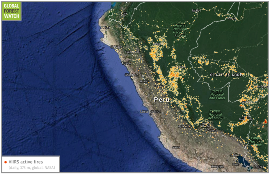
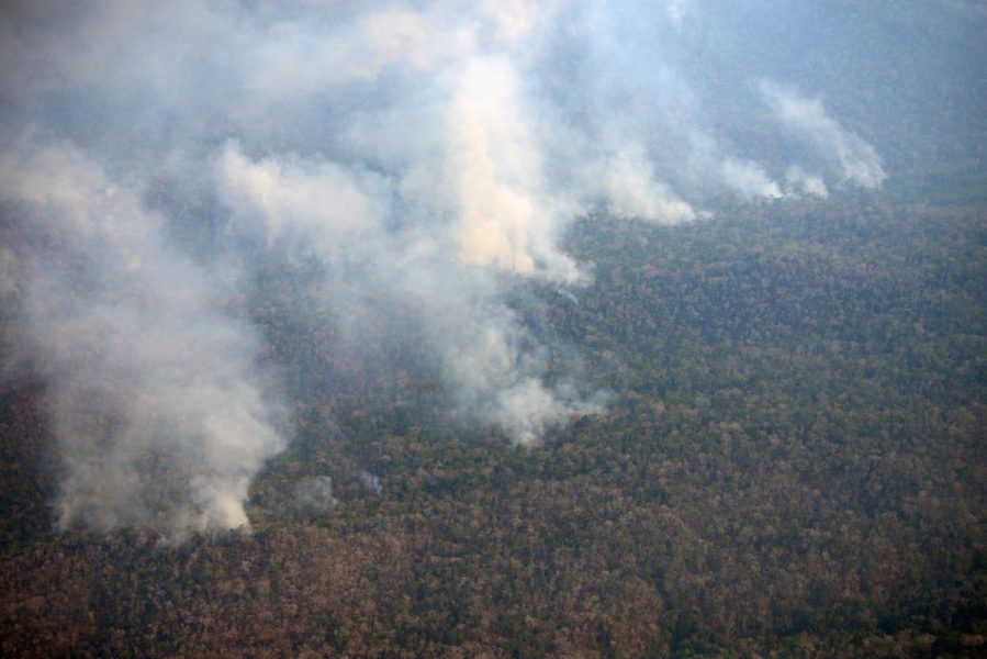
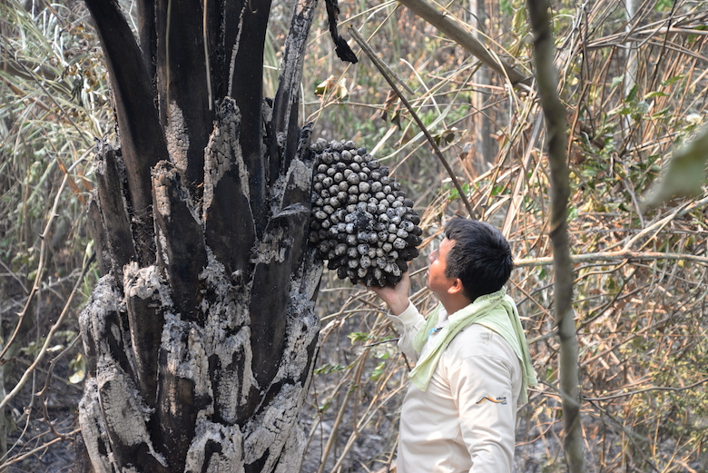
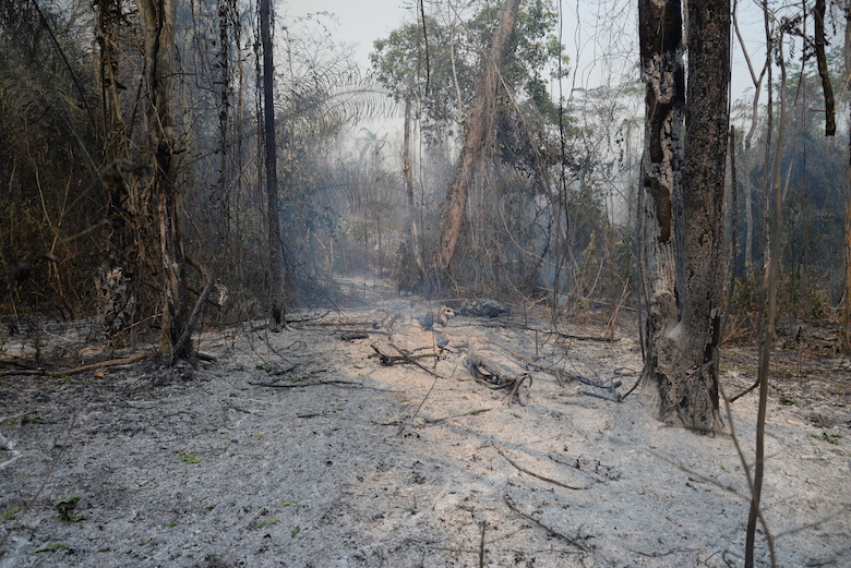
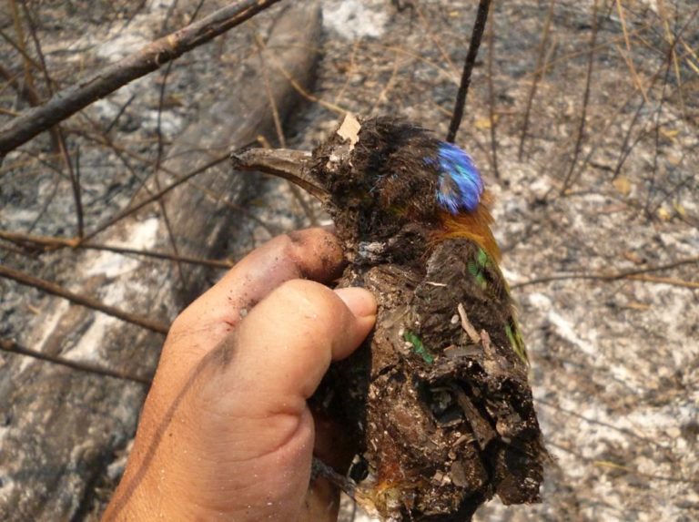
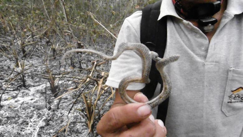
  2. Changes in rainfall patterns --- droughts and fires in some areas, flooding in other areas. See the section above on the recent droughts, for example!
  3. Increased likelihood of extreme events--- such as flooding, hurricanes, etc.
  4. Melting of the ice caps --- loss of habitat near the poles. Polar bears are now thought to be greatly endangered by the shortening of their feeding season due to dwindling ice packs. 
  5. Melting glaciers - significant melting of old glaciers is already observed.
  6. Widespread vanishing of animal populations --- following widespread habitat loss.
  7. Spread of disease --- migration of diseases such as malaria to new, now warmer, regions.
  8. Bleaching of Coral Reefs due to warming seas and acidification due to carbonic acid formation --- One third of coral reefs now appear to have been severely damaged by warming seas.
  9. Loss of Plankton due to warming seas --- The enormous (900 mile long) Aleution island ecosystems of orcas (killer whales), sea lions, sea otters, sea urchins, kelp beds, and fish populations, appears to have collapsed due to loss of plankton, leading to loss of sea lions, leading orcas to eat too many sea otters, leading to urchin explosions, leading to loss of kelp beds and their associated fish populations. 

Where do we need to reduce emissions?


In reality, we will need to work on all fronts - 10% here, 5% here, etc, and work to phase in new technologies, such as hydrogen technology, as quickly as possible. To satisfy the Kyoto protocol, developed countries would be required to cut back their emissions by a total of 5.2 % between 2008 and 2012 from 1990 levels. Specifically, the US would have to reduce its presently projected 2010 annual emissions by 400 million tons of CO2 . One should keep in mind though, that even Kyoto would only go a little ways towards solving the problem. In reality, much more needs to be done.


The most promising sector for near term reductions is widely thought to be coal-fired electricity. Wind power, for example, can make substantial cuts in these emissions in the near term, as can energy efficiency, and also the increased use of high efficiency natural gas generation. 

The potential impact of efficiency should not be underestimated: A 1991 report to Congress by the U.S. National Academy of Sciences, Policy Implications of Greenhouse Warming, found that the U.S. could reduce current emissions by 50 percent at zero cost to the economy as a result of full use of cost-effective efficiency improvements.

Discussing Global Climate Change:

 Here is a useful list of facts and ideas:
  1. Given the strong scientific consensus, the onus should now be on the producers of CO2 emissions to show that there is not a problem, if they still even attempt to make that claim. Its time to acknowledge that we are, at very least, conducting a very dangerous experiment with Earth's climate.
  2. A direct look at the data itself is very convincing and hard to argue with. Ask a skeptical person to look at the data above. The implications are obvious. The best source of data is probably the IPCC reports themselves, which are available at www.ipcc.ch (see, for example, the summaries for policy makers).
  3. The recent, record-breaking warm years are unprecedented and statistically significant. It is a fact that they are very statistically unlikely to be a fluctuation (and now we can point to specific side effects from those warm temperatures that appear to have induced recent worldwide drought).
  4. Lastly, but perhaps most importantly, whether or not you believe in global warming per se, the fact remains that the carbon dioxide levels are rising dramatically --- there is no debate about this. If we continue to use fossil fuels in the way we presently do, then the amount of carbon we will release will soon exceed the amount of carbon in the living biosphere. This is bound to have very serious, very negative effects, some of which, such as lowering the pH of the ocean such that coral cannot grow, are already well known.

Response of Government: Develop "Carbon Sequestration" Technology


Many government agencies around the world are very interested in maintaining fossil fuel use, especially coal. It should be noted that US energy use, which is enormous, is increasing, not decreasing. Furthermore, we are not going to run out of coal in the near term (oil may begin to run low sometime after 2010). Methods for reducing carbon emission levels while still burning coal are now investigation by government and industry, as we now discuss. 

We believe that a major increase in renewable energy use should be achieved to help offset global warming. While there are some US government programs aimed in this direction, there is simply not enough money being spent yet to achieve this goal in a timely manner. A primary goal of many new programs is not to increase renewables, but rather, is to find ways to capture the extra CO2 from electricity generation plants and "sequester" it in the ground, the ocean, or by having plants and soil organisms absorb more of it from the air.

Possible Problems with Carbon "Sequestration"


One of the Carbon sequestration approaches under investigation is the possibility of depositing CO2 extracted from emission streams in large pools on the Ocean bottom. It is possible that such pools will not be stable, and may either erupt to the surface, or diffuse into the ocean and alter the oceans pH.

Another scheme under investigation is the idea of stimulating phytoplankton growth on the ocean surface by dusting the surface with iron (the limiting nutrient). This will cause an increased uptake of carbon by the plankton, part of which will find its way to the ocean bottom. Fishing companies are considering using this to increase fish harvests while simultaneously getting credit for carbon sequestration. Serious ecological disruptions could occur, however, especially if this approach is conducted on a sufficiently large scale.

Another idea is to stimulate Earth's terrestrial ecosystems to take up more carbon dioxide. While the impacts here are more difficult to ascertain, an important point to note is that these systems are not thought to be able to completely absorb all the extra CO2 . At best, they may be sufficient to help the US stabilize carbon emission rates for a few decades, but even if this is achieved, stabilization of rates are not likely to return the Earth to pre-industrial carbon levels. Worse, biological feedbacks to global warming, such as forest fires, drying soils, rotting permafrost, etc, may actually greatly accelerate carbon emissions, i.e. we may experience massive carbon de-sequestration.

Another major approach under consideration is to pump CO2 into old oil and gas wells. While seemingly attractive, it must be kept in mind that for this to be truly effective, it would have to be done on a world wide scale, include many sources of CO2 , including many sources which are presently small and widely distributed (such as car emissions, and not just coal plant emissions). All of this CO2 would need to be captured, transported, injected into old wells, and then the wells would need to be sealed and monitored. It is not clear that this would be affordable at all, and that there would be adequate capacity or assurance that CO2 would not leak out in massive quantities. 

In the worst case scenario, carbon sequestration efforts may simply fail, but also end up being a political tool that is used to seriously delay a transition to renewable energy sources, and also possibly create many new environmental problems problems while prolonging old ones.

In the best case scenario, given the truly enormous amount of CO2 we are presently emitting, some sequestration approaches may serve as a useful bridge to curbing emissions while the transition to renewables is being made.


What is Acid Rain?

Acid rain, or acid deposition, is a broad term that includes any form of precipitation with acidic components, such as sulfuric or nitric acid that fall to the ground from the atmosphere in wet or dry forms.  This can include rain, snow, fog, hail or even dust that is acidic.  

What Causes Acid Rain?

This image illustrates the pathway for acid rain in our environment.
Acid rain results when sulfur dioxide (SO2) and nitrogen oxides (NOX) are emitted into the atmosphere and transported by wind and air currents.  The SO2 and NOX react with water, oxygen and other chemicals to form sulfuric and nitric acids.  These then mix with water and other materials before falling to the ground.

While a small portion of the SO2 and NOX that cause acid rain is from natural sources such as volcanoes, most of it comes from the burning of fossil fuels.  The major sources of SO2 and NOX in the atmosphere are:
  • Burning of fossil fuels to generate electricity.  Two thirds of SO2 and one fourth of NOX in the atmosphere come from electric power generators.
  • Vehicles and heavy equipment.
  • Manufacturing, oil refineries and other industries.
Winds can blow SO2 and NOX over long distances and across borders making acid rain a problem for everyone and not just those who live close to these sources.

Forms of Acid Deposition

Wet Deposition

Wet deposition is what we most commonly think of as acid rain.  The sulfuric and nitric acids formed in the atmosphere fall to the ground mixed with rain, snow, fog, or hail.  

Dry Deposition

Acidic particles and gases can also deposit from the atmosphere in the absence of moisture as dry deposition.  The acidic particles and gases may deposit to surfaces (water bodies, vegetation, buildings) quickly or may react during atmospheric transport to form larger particles that can be harmful to human health. When the accumulated acids are washed off a surface by the next rain, this acidic water flows over and through the ground, and can harm plants and wildlife, such as insects and fish.
The amount of acidity in the atmosphere that deposits to earth through dry deposition depends on the amount of rainfall an area receives.  For example, in desert areas the ratio of dry to wet deposition is higher than an area that receives several inches of rain each year.

Measuring Acid Rain

A diagram showing where various substances fall on the pH scale.
Acidity and alkalinity are measured using a pH scale for which 7.0 is neutral. The lower a substance's pH (less than 7), the more acidic it is; the higher a substance's pH (greater than 7), the more alkaline it is. Normal rain has a pH of about 5.6; it is slightly acidic because carbon dioxide (CO2) dissolves into it forming weak carbonic acid.  Acid rain usually has a pH between 4.2 and 4.4.

Policymakers, research scientists, ecologists, and modelers rely on the National Atmospheric Deposition Program’s (NADP) National Trends Network (NTN) for measurements of wet deposition. The NADP/NTN collects acid rain at more than 250 monitoring sites throughout the US, Canada, Alaska, Hawaii and the US Virgin Islands. Unlike wet deposition, dry deposition is difficult and expensive to measure. Dry deposition estimates for nitrogen and sulfur pollutants are provided by the Clean Air Status and Trends Network (CASTNET). Air concentrations are measured by CASTNET at more than 90 locations.
When acid deposition is washed into lakes and streams, it can cause some to turn acidic. The Long-Term Monitoring (LTM) Network measures and monitors surface water chemistry at over 280 sites to provide valuable information on aquatic ecosystem health and how water bodies respond to changes in acid-causing emissions and acid deposition.

From conflict to partnership, a Kalimantan community and logging company manage the forest together


Langkah Jones Lokan and his partners have come a long way as they trudge farther into the East Kalimantan forest. Sixteen years ago the company Jones now works with showed up with heavy machinery and began felling valuable trees.

“They destroyed cemeteries,” says Jones, a middle-aged Dayak man. “There was no compensation.”

In 1999 Indonesia was emerging from economic crisis and found itself just a matter of months into a precarious democratic transition. The 31-year rule of General Suharto had come to an abrupt end the previous year, but much of the damage here in Borneo had been done. The strongman’s three-decade focus on food security and ambivalence to the value of the Kalimantan tree line led to one of the fastest periods of deforestation in history. PT Sumalindo Lestari Jaya was just one of many timber companies given carte blanche to lay waste to Kalimantan’s lowlands – in 1999 the company arrived to haul down trees in this part of Berau regency, where five villages already stood.

Communities received nothing when Sumalindo’s heavy machines moved through the concession, rolling through sacred sites and cutting down fruit trees that contributed to subsistence livelihoods. One of Indonesia’s ubiquitous land conflicts began to set in. But in 2000 the villages and the company successfully mediated a solution together with the local government and The Nature Conservancy, an international NGO.

TNC originally came to Berau to work on protecting orangutan habitats farther up the Kelay River.

“Then we saw there were other priorities in Berau, including in Segah [subdistrict],” Indah Astuti, a community development specialist at TNC, tells Mongabay. “TNC began communicating with Sumalindo and the five villages in Segah so we could know the expectations of both parties.

“People said they needed Sumalindo – they needed them for the roads, economic activity, social programs – they could help with all of that. But the people wanted proper forest management. They didn’t want their cemeteries or fruit trees destroyed.”
Long Laai is one of the villages in Segah that found itself in Sumalindo’s logging concession in 1999. Photo by Indra Nugraha
The mediation produced an agreed framework for compensation for the five affected villages. A memorandum of understanding required the company to avoid sacred sites and it marked as untouchable areas of high conservation value.

Then, in 2003, collective action organization BP Segah was formed, led by Jones, to oversee the deal.

More than a decade on and Jones is out monitoring the forest concession together with Sumalindo staffers. BP Segah now represents the interests of four of the five originally affected villages, after one withdrew from the organization in 2009. Long Ayap, Long Laai, Long Okeng and Long Paai today jointly manage a concession spanning 63,500 hectares.

BP Segah’s role is to monitor Sumalindo’s activities to ensure maximum transparency. Annual working plans are made public and BP Segah facilitates consultation with the four villages. It serves as a public forum for complaints and is charged with the distribution of compensation payments to the villages.

“We also help organize what activities will be carried out by the community and the company,” Jones says. “Sumalindo also provides scholarships, and stipends for village officials as well as helping develop roads, electricity and suchlike.”

Last year the residents were given compensation payments of 200,000 rupiah per person, around $14.

“Newborn babies receive it as well – it’s calculated per head,” Jones says. “Today it is transparent.”
Jones (center) marks up trees with a Sumalindo official. Photo by Indra Nugraha
The payout is hardly a king’s ransom. However it is significantly higher than that mandated by the Berau government. The regency issued a decree stating residents are entitled to just 3,000 rupiah per cubic meter of harvested timber. An agreement struck between the company and residents, however, raised that to 33,000 rupiah. Today around 1,000 people receive the payment.

“If you add up the 33,000 rupiah payment and don’t take into account scholarships and other social payments to the people it comes out to around 1 billion rupiah,” Andi Amiruddin, site manager for Sumalindo, tells Mongabay.

Local politicians are also heaping praising on the partnership and calling for other companies to follow suit.

“This is a good example – there’s mutual respect between the people and the company,” Hamzah, head of the West Berau Forest Management Unit, tells Mongabay. “The compensation is the largest of any company in Berau. In another concession the company pays just 3,000 rupiah, only fulfilling their obligations under the regency decree.”
Sumalindo officials scrutinize a map of trees ready to be felled. Photo by Indra Nugraha
More needs to be done, however, to give people a deeper stake in the concession. Observers say local residents need greater training in environmental science, social management and planning as well as direct access to monitor the availability of seedlings for replanting programs.

“The methods should be kept straightforward so the public can become involved more directly,” Hamzah says, adding that he wants to see greater marking and mapping of trees carried out by the public. “They need to be taught how to use GPS.”

An added benefit of the closer ties between local communities and the concession holder is greater security and additional checks against illegal activity.

“The role of BP Segah goes beyond monitoring, it stretches to security of the area,” Indah says. “There is no more illegal logging here now.”

Back in the field Jones is moving through the concession marking up trees with the company.

“This is a monthly routine,” he says. “We don’t have cars so Sumalindo runs us up here.”
Jones inspects a nursery for rubber tree seedlings. Photo by Indra Nugraha
The routine forms just one small part of a complex brief spread across a vast archipelago where deforestation has marched unfettered for decades. Major pulp-and-paper firms and palm oil giants are lining up to announce new pledges aimed at zero deforestation in the years to come. Compliance with those pledges remains far from certain, while a long list of seemingly intractable problems spanning fires started by smallholders to illegally awarded new licenses threatens Indonesia’s rainforests further.

But here in Berau a land conflict turned into a partnership over 16 years illustrates the multiple benefits offered by properly engaging local communities in concession management – whether it is boosting livelihoods or security against illegal logging.

Land grabbing and environmental destruction could now be prosecuted under international law

The International Criminal Court (ICC), housed at The Hague in the Netherlands, has mostly focused on human rights abuses and war crimes committed during armed conflicts throughout its 14-year history. But the court has now signaled that it will begin investigating crimes such as land grabbing, environmental destruction, and forced evictions that are often committed during peacetime in the pursuit of profit.

In a detailed policy paper on case selection and prioritization released last week, ICC Prosecutor Fatou Bensouda wrote that “crimes that are committed by means of, or that result in, inter alia, the destruction of the environment, the illegal exploitation of natural resources or the illegal dispossession of land” will be given “particular consideration” for prosecution.

The significant change to ICC’s strategy comes as Bensouda is poised to deliver a decision on whether or not to investigate a case filed in 2014 by international human rights lawyer Richard Rogers of the law firm Global Diligence LLP, which alleges a number of human rights violations were committed during a series of land seizures in Cambodia thatforced hundreds of thousands of people from their homes.

“The systemic crimes committed under the guise of ‘development’ are no less damaging to victims than many wartime atrocities,” Rogers said in a statement. “Forced population displacement destroys entire communities and leads to instability or even war. The ICC Prosecutor has sent a clear message that such offences may amount to crimes against humanity and can no longer be tolerated.”

The Cambodia case will be a key test for the ICC’s new policy, according to Global Witness, a London- and Washington, D.C.-based NGO. “If accepted, this would be the first case in international criminal law where the primary allegations relate to the illegal exploitation of land. Corporate actors in Cambodia could be the prime targets for investigation.”

Many local and traditional communities across Africa, Asia, and Latin America lack legal rights to the land they live on, even when they’ve lived there for several generations. Meanwhile, in many key consumer countries, including the United States and several EU nations, importers and investors are not legally bound to ensure that commodities like gold, palm oil, or timber were legally or ethically produced in the source country.

But expanding the court’s focus to include environmental crimes “could reshape how business is done in developing countries,” Global Witness said, as company executives, politicians, and any other individuals complicit in such crimes could be held criminally responsible under international law.

At least 38.9 million hectares (about 96.1 million acres) of land in developing countries — an area the size of Germany — has been leased to investors since 2000, the group notes. This has led to millions of people being evicted from their land illegally and, often, violently.

Global Witness data shows that more than three people were murdered every week in 2015 while defending their land from theft and environmentally destructive industries, making it the deadliest year on record for environmental activists. Conflicts precipitated by mining projects were the number one cause of these killings, the group found, followed by agribusiness, hydroelectric dams, and logging.

“Chasing communities off their land and trashing the environment has become an accepted way of doing business in many resource-rich yet cash-poor countries,” Gillian Caldwell, Executive Director at Global Witness, said in a statement.

“[Last week’s] decision by the ICC shows that the age of impunity is coming to an end. Company bosses and politicians complicit in violently seizing land, razing tropical forests or poisoning water sources could soon find themselves standing trial in the Hague alongside war criminals and dictators. The ICC’s interest could help improve the lives of millions of people and protect critical ecosystems.”
indonesia_20152386

Thursday 22 September 2016

Wildfires threaten Peruvian Indigenous communities and national park

This story was investigated by Mongabay’s Latin America (Latam) team and was first published in Spanish on our Latam site on September 15, 2016.

A major fire event has affected around 20,000 hectares of rainforest in the central Amazon region of Peru. Satellite data from NASA show several fires burning in the protected buffer zone around a national park and Indigenous reserve, and reports on the ground reveal the uncontrolled fires are having damaging impacts on local communities.

“The fire originated on the right bank of the Ene River, which is a valley that is part of Río Tambo District in the province of Satipo, Junin Department,”Iván Cisneros, mayor of Río Tambo, told Mongabay Latam. “In this section of the country, the Otishi National Park is located west of the Ashaninka Communal Reserve. A ring of communities borders the reserve. The fire is currently affecting this ring, and it has even reached part of the national park.”

Conservationists had previously warned authorities of the fires. In early August, 24 experts signed an open letter advising government officials in Brazil, Bolivia, and Peru about the issue. In Peru, a document was sent to the office of the Presidency of the Republic, the Ministry of Environment and the Ministry of Agriculture. Pronaturaleza – a Peruvian foundation for nature conservation – was responsible for sending the document. At press time, no response from the authorities had been forthcoming.

“We have sent an alert about a month ago. And the fire hotspots that our Brazilian friends were monitoring already showed fire two months back. Now, local authorities have to deal face to face with these fires, but they do not have the tools to do it,” said Ernesto Ráez, tropical ecologist and member of the Pronaturaleza Foundation to Mongabay Latam.
Data from NASA displayed on the forest monitoring platform Global Forest Watch (GFW) show fires approaching the Ashaninka Communal Reserve and Otishi National Park. By September 15, the fires had moved within two kilometers of the reserve and five kilometers of the national park.
Wildfires aren't just a problem in Junin Department, but are occurring all over the Peruvian Amazon. In all, NASA recorded almost 10,000 fires in Peru during the past week (September 12 to September 19).
Wildfires aren’t just a problem in Junin Department, but are occurring all over the Peruvian Amazon. In all, NASA recorded almost 10,000 fires in Peru during the past week (September 12 to September 19).


Ráez further explains that there is no plan to deal with such emergencies: “even though the Forestry law mentions forest fires, plans have not yet been developed nor have the capabilities to address them. Now, the issue is not to attack the fires, it is to learn to avoid them.”

The alert

On September 13, villagers and authorities called to warn about a major fire that was affecting the right bank of the Ene River, according to Cisneros. Cisneros admits he is concerned about the situation, and more so after flying over the area where the fire happened.

“First there is no visibility [because of the] smoke clouds the area,” Cisneros told Mongabay Latam. “There is no wind from north to south in that area; the extension is 40 to 50 kilometers along the Ene River. The fire has crossed the river, which is unusual. There is fire on both sides (banks), which threatens communities, including those of Potsoteni and Caparucia. (The fire) has devastated staple crops and cocoa, I think it will damage about 50 hectares of cocoa.”
Fires bun in Río Tambo District. Photo courtesy of the Río Tambo District Municipality
Fires burn in Río Tambo District. Photo courtesy of the Río Tambo District Municipality

Two communities seriously threatened by the advance of the fire are Caparocia Potsoteni and Ashaninka. The situation had become so dire that on the morning of Thursday, September 15, a commission was sent by river to coordinate the evacuation and relocation of the residents of these communities, Cisneros confirmed.

As of September 15, there were 15 fire hotspots, according to the Peruvian National Service of Natural Protected Areas (SERNANP). Marco Pastor, a SERNANP official, mentioned that a SERNANP brigade entered the affected area a few days ago to assess the magnitude of the fire. He told Mongabay Latam that drier than normal conditions in the region may have contributed to the fires.

“We need an aerial survey. We are coordinating with the Peruvian Air Force to conduct one,” Pastor said. “Now we could say that there are 15 fire hotspots, maybe a little more, but these are spread across several sites. Why? Because they are triggered in places where vegetation is drier and areas of grassland vegetation.”

However, so far there is no official report confirming what started the wildfires, according to Cisneros, who said it is the largest fire event that has occurred in the region in the last ten years.
Ashaninka communities the most affected
Steffy Rojas is a member of the technical team of the Ashaninka central station of the Ene River (CARE), an organization that represents and defends the rights of 17 Indigenous communities. CARE has been working in the area for more than ten years. Mongabay Latam spoke with Rojas to find out what are the most affected communities and obtain information on the development of the fire.

According to Rojas, “there have been 11 locations directly affected: eight native communities and three rural communities. The situation has become more difficult due to the drought caused by climate change. There are 28 points of fire outbreaks, three around the Ashaninka Communal Reserve and four points just 950 meters away from the reserve. Since August, when the first reports of the fire started, there has been 36 kilometers of continuous fire spreading over 105 kilometers.”
Photo courtesy of Río Tambo District Municipality
Local officials say that sudden changes in the climate may be responsible for the fires. Photo courtesy of the Río Tambo District Municipality


This information coincides with the fire assessment made by a team composed of specialists from SERNANP, the National Forest and Wildlife Service (SERFOR), the Satipo Fire Company, the Peruvian Army and the Río Tambo District Municipality. In a preliminary report, provided by Rojas, they write that 11 native communities have been affected: Potsoteni, Saniveni, Boca Anapati, Samaniato, Caperucia, Pitziquia, Tziquireni, Centro Meteni, Fé y Alegría, Selva de Oro, and Sol Naciente.

Rojas said that the first report of a forest fire in the community of Potsoteni on August 19. Rojas’ statement aligns with observation made by a team from Mongabay Latam two weeks ago when they visited Potsoteni, located three hours from Puerto Ocopa along the Ene River. The fire appeared to have approached dangerously close to the community; even a few meters from its boundaries the reporting team found traces of a massive fire that occurred days earlier.

The fire reached several hectares of land and affected yucca crops, the primary source of food for the population, according to Walter Tishirovanti, community chief of Potsoteni.

“The fire is near the Otishi Park. They have ruined crops. I do not know what is going to supply the people of the community,” Tishirovanti told Mongabay Latam.
Local residents have been affected by the fires, and some have lost their staple crops. Photo courtesy of the Río Tambo District Municipality


CARE’s Rojas said defense against the fires has been solely the responsibility of community-members.

“So far the state has not done anything concrete” Rojas told Mongabay Latam.
A changing climate
All interviewees for this report agree that sudden changes in the regional climate have played a hand in the fires. Mayor Ivan Cisneros says that there is currently a severe drought in the district of Río Tambo: many waterholes have dried up and “the communities and the people are experiencing water shortages for human consumption.” The temperature has reached high levels, with peaks of 40 degrees Celsius, which is “highly unusual” and something that had not happened for at least 30 years, Cisneros told Mongabay Latam. He also mentioned that due to the effects of climate change they have “had the strongest summer in the history of the district, and because of that the forest is very susceptible to any fire. Even the green plants catch fire.”
Photo courtesy of Río Tambo District Municipality
Many animals could not escape the fire. Photo courtesy of the Río Tambo District Municipality
This snake died in the blaze. Photo courtesy of the Río Tambo District Municipality


Marco Pastor of SERNANP warns that it is not the only place where fires have been reported: “this season we had fires in Ayacucho and one near Cusco. Right now there is one in Cusco. They are outside protected areas, but they are generating multiple foci due to the extremely dry weather conditions. We are now at the end of September and the rainy season should start. In some cases [fires occur] due to the people who suddenly burn the land and the fire turns out of control.”

As of press time, the fires continue to spread. Ernesto Ráez, one of the experts who signed the letter warning authorities, sees a clear way out to prevent these disasters: “we need to prohibit burning, it is simple. If we are experiencing dry conditions with high temperatures, people should not burn land because it will go out of control.” Ráez says that this ban should be treated differently in each region, “in the areas with risk of fires burning out of control, for example near woods or farms, the ban should be enforced, or in situations where there is a short forecast notice that indicates strong winds or high temperature.

Cisneros told Mongabay Latem that he feels powerless because he hasn’t found a solution to the problem. On Thursday, he approached the Congress of the Republic of Peru to seek help from lawmakers.