Tuesday 29 November 2016

Arctic Ocean

 Arctic Ocean 

If you had to pick an ocean to swim, you would not pick the Arctic, right? That’s because it’s the coldest ocean on Earth, and only the species adapted to its temperature are capable of living there.
 This body of water is the smallest and shallowest of the oceans, and it is in the northern hemisphere. Still, it is 1.5 times larger than the United States. The world “Arctic” comes from the name of the constellation Arktos, which in Greek means “bear.”
Regardless its unbearable cold temperatures, this territory has been inhabited for about 20,000 years by the Inuit and the Yupik, who have physical and physiological adaptations to living in these extreme conditions.
This ocean has an area of approximately 15,558,000 square kilometers and a total of 45,389 kilometers of coastline. It covers about 3.17 percent of Earth’s surface. Its waters touch the northern regions of Alaska, Canada, Norway, Iceland, Russia, and Greenland, and it surrounds several islands. Its area includes Baffin Bay, Barents Sea, the Beaufort Sea, the Chukchi Sea, the Greenland Sea, Hudson Bay, the Kara Sea, the Laptev Sea, the White Sea, Hudson Strait, the Siberia Sea and others. It connects to the Pacific Ocean through the Bering Strait and the Atlantic Ocean through the Greenland Sea and the Labrador Sea. Its southern boundary is the Arctic Circle, at parallel 66°33′ north.
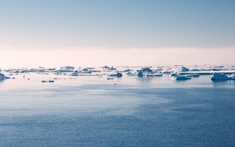
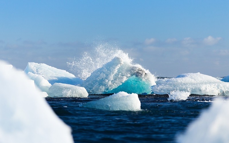
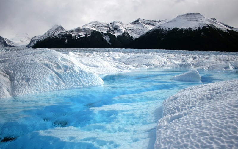
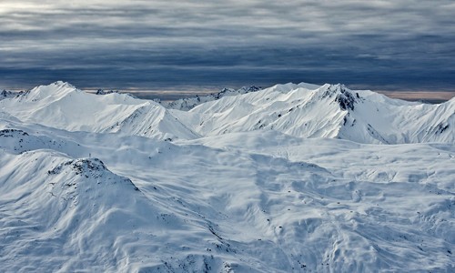
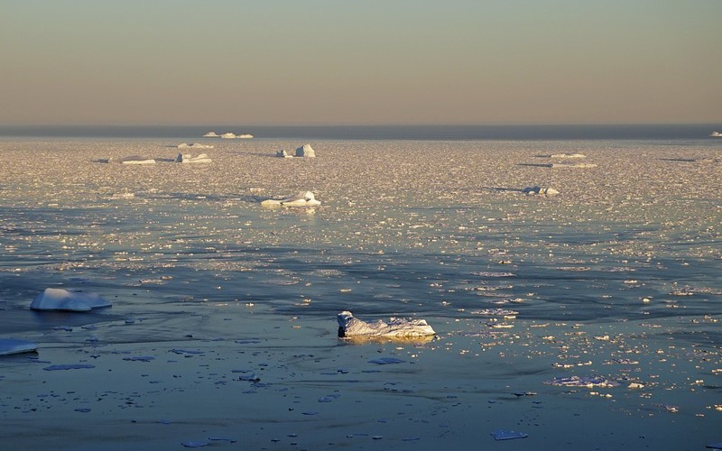
In the Arctic, massive ice sheets of two or three meters thick float around freely, continually shifting due to winds and ocean currents. If these ice chunks collide, they form irregular lines of ice, known as pressure ridges, which can be three times as thick as the individual pieces.
In winter, the temperature fluctuates between -50°C and -1.1°C.

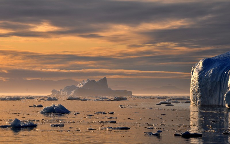
Properties of the Arctic Ocean.

During the summer, the ice caps are surrounded by the ocean, but in the winter they double in size. The Arctic climate is described as polar, characterized by a perennial cold. The islands have a permafrost layer, in other words, a layer of ice on the soil’s surface. Other land regions like Alaska have a tundra biome.
In the winter, the sun is conspicuously absent, the sky is clear, and weather conditions are stable, but summer has permanent sun and humid environments, occasionally pounded by cyclones and snowstorms. In winter, the temperature fluctuates between -50°C and -1.1°C and in summer, the temperature can be up to 10°C. This ocean has the lowest salinity of any ocean due to low evaporation rates and freshwater inflows.

Properties of the Arctic Ocean

The ocean floor has three main underwater ridges:

1. The Nansen-Gakkel ridge, which extends north of western Russia
.
2. The Alfa mountain ridge, a plane range with peaks of about 3,000 meters.
3. The Lomonosov Ridge, a mountain range between 3,000 to 3,700 meters high.
It is also divided into three large bodies of water, depending on the depth:
1. Arctic Deep Water, the deepest part, beginning at about 900 meters below the surface
2. Atlantic Water, found between 150-900 meters deep and having the same level of salinity as the Arctic Deep Water but warmer.
3. Arctic Surface Water, above 150-200 meters deep and is a subsurface layer with swift currents.

Economic Importance of the Arctic Ocean
.

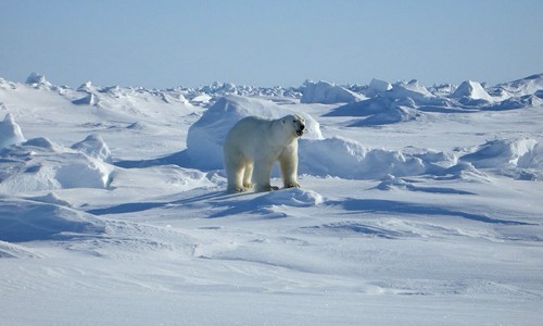
The cold conditions do not deter the proliferation of several species there. Narwhals, walruses, belugas, seals, bowhead whales, and Lion’s Mane Jellyfishes, which grow up 2.4 meters long, inhabit the waters of this ocean. Plankton, algae, various fish species, and polar bears also live in this environment.
In the ground, there are vast deposits of oil, natural gas, and metals, which are essential resources for various countries. Its waters 
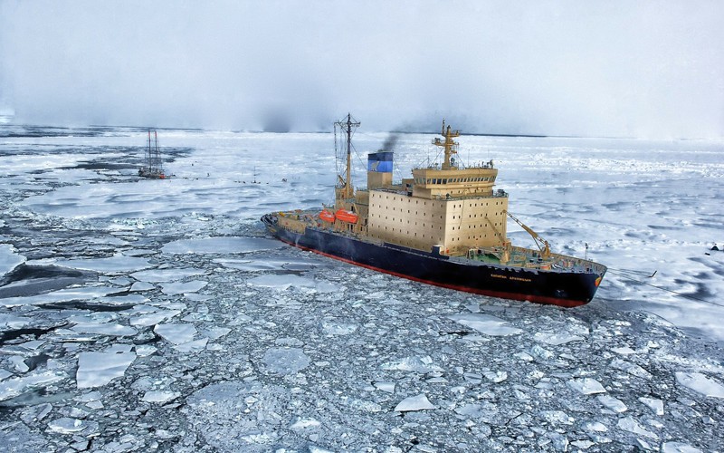
are navigable taking the proper care to avoid icebergs; between March and April, ice covers a large part of the ocean. This challenge has become more important as some tests indicate that it could hold more than 25 percent of the undiscovered deposits of oil and gas.
This ocean is also a maritime link between the east and western Russia and North America. However, the center of this ocean is disputed between Norway, Denmark, United States, Canada, and Russia.

Economic Importance of the Arctic Ocean.

Conservation of the Arctic Ocean.

This ocean is evidently affected by climate change as due to the rising of global temperatures, the ice layer gradually thins. The thaw could cause serious flooding in the future, burying some countries under water, pollute some territories because its high concentration of radioactive contaminants, and alter the direction of ocean currents which could cause severe weather disruptions.
Along with the above, animal species would also be affected. Some researchers think that by the year 2040, the Arctic could be entirely melted because the ice pack of this ocean shrinks by eight percent each year.

Quick Facts.
– It is the smallest ocean.
– The Arctic Ocean is the only home of polar bears.
– Its deepest point is the Fram Basin, which has a depth of 4,665 meters.
– It is five times larger than the Mediterranean Sea.
– During summer, its ice shrinks by 50 percent.

Antarctic Ocean

Antarctic Ocean 

The Antarctic Ocean, or the Southern Ocean, is the last ocean to be designated as such. Indeed, not all countries and researchers recognize it even though the U.S. Board on Geographic Names and the International Hydrographic Organization recognizes it already. Its limits were defined by this organization in 2000 but need confirmation from most oceanic agencies and administrations.
It differs from the other oceans as it is the only one that surrounds a continent. It comprises the waters located in the southern hemisphere, whose boundaries are the Antarctic Convergence or latitude 60° south and the Antarctica coast. It covers all the 360° of longitude. It connects the principal southern oceanic basins as well as the sea surface with deeper layers of water.
The Antarctic Ocean, has an area of about 21.96 million square kilometers and includes:
– the Weddell Sea,
– the Lazarev Sea,
– the Riiser-Larsen Sea,
– the Amundsen Sea,
– the Cosmonauts Sea,
– the Cooperation Sea,
– the Davis Sea,
– the Bransfield Strait,
– part of the Drake Passage,
– the D’Urville Sea,
– the Somov Sea,
– part of the Scotia Sea, and
– the Ross Sea.
This ocean has the largest ocean current, called the Antarctic Circumpolar Current.

Properties of the Antarctic Ocean.

This ocean has the largest ocean current, called the Antarctic Circumpolar Current, and since it connects the Pacific, Atlantic, and Indian Ocean basins, it influences the climate of the entire planet. It takes 135-145 million cubic meters of water per second from west to east along 20,000 Antarctic kilometers at a speed of 0.5 meters per second. This current distributes heat and influences rainfall patterns and temperatures.

Properties of the Antarctic Ocean.
Antarctic Ocean.

It has an average depth of 4000-5000 meters and touches around 17,968 kilometers of Antarctic coastline. A continental shelf about 260 kilometers wide and a maximum of 2600 kilometers lies beneath this ocean. 
Its temperature ranges between 10°C and -2 °C, but it has the strongest winds and waves in the world, as the temperature of the ice contrasts the open ocean. During winter, the sea freezes at a latitude 65° south at the Pacific and a latitude 55° south in the Atlantic Ocean sector. During winter most coastal waters are frozen except in some areas.
Salinity is lower in the north, near the Antarctic Convergence where the colder waters flow below, the less cold waters of the Antarctic convergence. This ocean is a huge deposit of carbon and contains about 50 times more than the atmosphere.

Economic Importance of the Southern Ocean.

Due to the low levels of iron and sunlight, productivity is not high. It is rich in nutrients and manganese nodules as well as possible oil and natural gas deposits. It is also home to over 10,000 species, all perfectly adapted to the weather conditions, such as penguins, squids, whales, seals, krill, and a variety of fish.
Fishing is relatively fruitful, being krill and hake the most caught species. Between 2006-2007 for example, 126,976 metric tons of these species were captured.
Illegal fishing affects the sustainability of the sea and reduces the availability of food for other species.
In the Antarctic territory, there are two seaports: McMurdo and Palmer. Offshore, there are a few anchor points. Not all the waters of this ocean are navigable due to the presence of ice blocks. Only a few research boats cross the latitude 60° South since neither private nor commercial navigation is allowed.

Conservation of the Antarctic Ocean.

The increase of ultraviolet radiation, as a result of the ozone hole, is a major concern. The ice whiteness reflects the heat and bounces it back into space, which increases the cold. Some experts think that ultraviolet radiation is responsible for the reduction of phytoplankton, the primary link in the food chain. Besides, illegal fishing affects the sustainability of the sea and reduces the availability of food for other species.
Some organizations implemented guidelines to diminish the abuse of its natural resources. For example, the International Whaling Commission prohibits whaling below latitude 40° South.
Quick facts:
• It covers 20 percent of the surface of all oceans and 4.3 percent of the face of the earth.
• Its narrowest part is the Drake Passage, which has only about 1000 kilometers wide between South 
America and Antarctica.
• It’s the fourth largest ocean.
• The maximum depth corresponds to the South Sandwich Trench, which is 7,235 meters deep.
• The Antarctic Circumpolar Current carries 150 times more water than the flow of all the rivers 
in the world.


Water Cycle

 Water Cycle 


You are probably already aware that water covers about 97 percent of the entire planet, right? Then maybe you’re familiar with the concept of the water cycle, a necessary process for life on Earth. However, you should know that the water cycle is more complicated than you think, and there are 15 components or elements in the process.
Water is never still. We’re not just talking about currents or tides, but also changes in their physical state: gaseous, liquid, and solid. The hydrological process is the process in which water moves in, on, and under the surface of the Earth, over and over again. Although it sounds simple, it forms the basis of the existence of living beings, as they use it for drinking and therefore, survival.

The Process of the Water Cycle.

We can’t say when and were the hydrological cycle begins because it never stops. However, you can take the oceans as a starting point for understanding the process.
Although usually a smaller number of steps are mentioned, there are about 15 steps or components in the water cycle:

1. Water stored in the oceans.

Most of the world’s water is in the oceans and a small percentage in glaciers and smaller bodies of water: rivers, lakes, ponds, etc. Oceans are therefore a kind of warehouse for a large quantity of the vital liquid and supply nearly 90% of the evaporate water that is part of the water cycle.

2. Evaporation.

It is a process that converts liquid water into gas or vapor, mainly due to solar radiation. This energy from the sun is essential for water to evaporate, which happens when it reaches 100°C, its boiling point.
At this stage, evaporated water joins with the transpiration of plants, so together the process is often referred to as evapotranspiration. Oceans, seas, rivers, and lakes provide nearly 90% of the moisture that evaporates, while plants provide the other 10%. In concrete terms, this state is characterized by the transformation of water into steam in the air.
The hydrological process is the process in which water moves in, on, and under the surface of the Earth, over and over again.

3. Water in the atmosphere.

At this point, the water in vapor form is contained in the atmosphere. The amount of water is still small. Imagine, if all the water in this layer of gas fell to Earth as rain, it would cover the ground with only 2.5 centimeters of water.

4. Condensation.

Water vapor in the atmosphere becomes drops of liquid water. This process creates clouds and fog, and it is the opposite of evaporation.
How does this happen? Well, the water molecules combine with dust, salt, and smoke and form tiny drops that grow and join to develop clouds; this only occurs at high altitude where there is cooler air which allows this process.

5. Precipitation.

The condensed water vapor falls to Earth’s surface as rain, snow, hail, sleet, fog drip, and snow pellets but most of the water from the clouds returns in the form of rain. All these kinds of precipitation happen due to the collision of the particles in water vapor clouds; it takes millions of cloud droplets to produce one raindrop.

6. Water stored in ice and snow.

The water cycle is not exactly a progression because some processes occur at the same time as others. Thus, the water stored in glaciers, ice fields, and snow plays a significant role in the cycle.

7. Meltwater flows into water bodies.

Frozen water flow contributes to the change and flow of rivers, creating movement and sometimes even natural disasters. However, it is a vital component of the water cycle.

8. Surface runoff.

The ground absorbs a portion of the rainwater and other precipitations. The interaction between precipitation and runoff varies according to time and geography, and can be diverted by human means according to need.

The hydrological process.
The process of the water cycle.

9. Streamflow.

The amount of water flowing in a river, stream, or creek. After rain falls, most of the water runs downhill over land in these bodies of water.

10. Stored freshwater.

Naturally, the water that ran into rivers, streams, and creeks remains in these natural “deposits” on the Earth’s surface.
Stored freshwater is vital for the survival of living organisms since physiologically, they are incapable of drinking salt water. Moreover, the amount of water in rivers and lakes is constantly changing.

11. Infiltration.

A small part of the precipitation water infiltrates the soil and rock materials. While some water remains in the most shallow layer, the rest infiltrates deeper and can replenish groundwater.

12. Groundwater discharge.

Some groundwater discharges into streams of surface water.

13. Springs.

Springs are common water bodies where groundwater flows to the surface.

14. Perspiration.

After discharge and storage, water can evaporate again through plants and re- enter the atmosphere.

15. Stored groundwater.

Water stored underground moves slowly. These aquifers are useful, last a long time, and make up a deposit that is part of the water cycle.

Thursday 24 November 2016

Lava

 Lava

A lava flow is a stream of molten rock which will pour out of an erupting volcano’s vent. This substance can be erupted either during the explosive activity or a non-explosive event. Most lava flows will move slowly but it will destroy anything in its path. But the good news is that due to the low speed of the flow most people should have a chance of getting away from it. The speed of the flow will depend on different factors and those include the viscosity of the substance, the steepness of the hill, channeling in the area and the amount that had been produced at the volcano’s vent.

Speed

As stated earlier flows can be rather slow but some can reach speeds of over 30 kilometers per hour. Most of the edges of the flow will travel at around 10 kilometers per hour provided that the slope is steep. However, on a flatter surface the speed can be less than one kilometer per hour. The viscosity of the lava will affect the speed as the higher viscosity the lower the speed. It is rare for a viscous lava flow to go over 8 kilometers per hour from their vent.

Destruction

Anything in the path of a lava flow will be destroyed and eventually buried by the flow. Some materials which will not fall will catch on fire due to the extremely high temperatures found in the flow. If the lava were to enter a body of water such as the ocean, lake or a river, the water will boil on contact. Vegetation stands no chance as it will simply be buried and burnt by the flow, creating methane gas. The good news, however, is that it is rare for deaths to happen due to flows and that is because of the low speed at which they move.

Injuries To People

Even though deaths are uncommon, injuries do happen when people stay close to a vent. People have been killed and injured when they approach a lava flow to get a better look. Most of the deaths related to flows usually have to do with the explosions that take place when the substance interacts with a body of water. Other things that could kill or injure a person include asphyxiation on toxic gases, collapse of a delta, pyroclastic flows and lahars which happen from melted water. Though it may be tempting to get a closer look, it is never recommended to do so as there is simply too much danger in the area of a flow.

No Rebuilding

When an area is affected by a volcano it is much different than what you would find with most other types of natural disasters. It is possible to rebuild a home after a tornado, hurricane or earthquake hits an area. However, when lava hits an area it is nearly impossible to rebuild there. The homes that were in the area are buried by the substance and the landscape changes immediately as it cools down. There is an entire new area which becomes really hard to build over and the owners may not want to anyway.

Evacuation

There are problems associated with evacuation of an area when a volcano is erupting. The flow of lava could cover evacuation routes so the cities that are in areas that could be affected need to design more than just a couple evacuation plans. When a volcano is believed to be close to erupting scientists can look at the conditions and make a prediction of where the flow will go but currently it is not an exact science so there is always a chance that the prediction will be wrong.


Types Of Volcanic Eruptions

Types Of Volcanic Eruptions 

In order to understand volcanoes it is important to understand the types of volcanic eruptions which are what in the end a volcano will mostly be known for. When people hear about an eruption the first thing that comes to mind is the explosive spew of lava which is seen in movies and even most of the documentaries but the fact is that some eruptions are very small and the amount of lava that will come out will not put anyone in danger. During an eruption other things besides lava are also expelled from the vent and that includes ash, blocks, gas and tephra. By observing the volcano’s activity prior to a possible eruption you can tell which type of eruption is possible.

Hawaiian Eruptions

The Hawaiian eruption will have fluid lava, which is sent into the air from the vent or the line of vents in jets. In these types of volcanic eruptions, the jets could last for several hours  which is called a “fire fountain.” When the bits of lava fall down after being shot up they can create lava flows or in other cases they will build hills which are called spatter cones. The flows of lava may also show up at the vents even when the fountaining has stopped. If the lava is flowing fast enough it could travel several miles before it hardens after cooling down.
The reason why these types of volcanic eruptions are called Hawaiian eruptions is because of the Kilauea volcano which can be found on Hawaii’s Big Island. This volcano is famous for its amazing fire fountains. In 1969 through 1974, Mauna Ulu had Hawaiian eruptions, which produced lava fountains that shot up over 1,000 feet while the eruption was taking place.

Strombolian Eruptions

A Strombolian eruption is a type of eruption that could be classified as low level. These types of volcanic eruptions were named after the Stromboli volcano in Sicily, which experienced this type of ejection several times. These eruptions can be small to medium when it comes to the volume with some periods of violence. A Strombolian eruption is a very distinct burst of lava that takes place at the mouth of a lava filled summit conduit. Because the lava flows during these eruptions are more viscous, they are thicker and shorter than other eruptions, such as Hawaiian ones.
However, because the eruption does not strongly affect the conduit system, these eruptions can last a long time. In fact, some volcanoes have produced continuous Strombolian eruptions for many decades. An example of a Strombolian eruption that lasted a shorter duration is the Paricutin volcano, which erupted continuously from 1943 to 1952. A longer lasting one is Mount Erebus in Antarctica which has had these eruptions for many decades and of course the namesake for this type of eruption, the Stromboli volcano in Italy has actually been producing these types of volcanic eruptions for thousands of years.

Vulcanian Eruption

Another one of the short but violent types of volcanic eruptions is the Vulcanian eruption. These eruptions can create extremely powerful explosions that cause material to travel at speeds greater than 800 miles per hour and gain an altitude of several kilometers. In addition, Vulcanian eruptions produce ash clouds and tephra in addition to pyroclastic density currents, which is a mixture of rock, gas and hot ash that flows in a manner very similar to fluids. The tephra from these flows is generally spread out over larger areas than the tephra emitted during Strombolian eruptions. Generally, the pyroclastic rock will create a volcanic cone made
of ash and the resulting ash will cover a large area surrounding the volcano.
These eruptions are caused by either a lava dome rupturing or when a plug of the lava from a volcanic conduit fragments and explodes. In addition to lasting anywhere from days to months or even years, these Vulcanian eruptions may also be a precursor to larger and more explosive eruptions. These types of volcanic eruptions are named after the small volcano found on Vulcano, an island in Italy.

Plinian Eruptions

The most spectacular and most violent of all types of volcanic eruptions is what is known as a Plinian eruption. This type of eruption happens when gassy magma is fragmented and associated with very viscous magma. The combination releases a huge amount of energy, which will create an eruption column which will contain ash, gas and could rise up to an altitude of 50 kilometers at very high speeds. Because the ash goes up so high, it could end up several thousand miles away from the volcano’s location. This type of eruption has been compared to a nuclear explosion because of the mushroom shaped eruption column it will create.
These types of volcanic eruptions are named after Pliny the Younger who was a Roman historian that made the comparison back in 79 A.D. when Mount Vesuvius erupted so Plinian eruptions were named after him. These types of eruptions do happen and the one that took place at Mount St. Helens in 1980 is one of the best examples. They are extremely dangerous and destructive and could destroy the entire top of the mountain. Ash and lava bombs can land several miles away from the volcano and the currents of lava will destroy anything in the surrounding area. Because of the amount of material released during an eruption it is possible that the mountain will go into a resting period right after the eruption.

Surtseyan Eruptions

The Surtseyan eruption is a hydromagmatic eruption. The lava or magma will interact with water in an explosive manner. Most of these eruptions will take place underwater when a volcano becomes too large, enough to break to the surface. When the water expands and turns into steam, any water that touches the hot lava will explode creating plumes of ash, scoria and steam.
In 1963, a Surtseyan eruption took place in Surtsey and that is where the name comes from. This eruption eventually switched from a Surtseyan to a Hawaiian type of eruption. In more recent times in 2009 near Tonga the volcanic island of Hunga Ha’apai started to erupt. The steam and ash rose over 5 miles in altitude.

How The Eruption Type Is Determined

There are several things that will help determine the types of volcanic eruptions. The first thing that you will be looking at is the gas and crystal content as well as the temperature of magma. Magma which contains a lot of crystal will be more likely to produce an explosion rather than a flow so some scientists are able to examine that before an eruption takes place. Another thing that influences the type of eruption that you will see is the gases in the volcano. When the gas cannot escape from the magma then it could cause an explosion but if it can be released without any explosion or maybe a few minor ones, the eruption may be a little milder.

Wednesday 23 November 2016

Denali National Park

Denali National Park 

Denali National Park and Preserve


The Denali National Park and Preserve can be found in Alaska. Inside the park, Mount McKinley which is the biggest or rather, the largest mountain in North America today. The park covers almost six million acres of land and of that land; over four million acres are owned by the government. Almost one million acres of land are of the national preserve and most federally owned also. However, in 1980, on the 2nd of December, over two million acres were established as the Denali Wilderness land.
There is a mix of habitats including the low elevations forest which home the deciduous taiga; and the tundra which are found at higher levels; and there is of course snow, glaciers and rocks found in the park also. Kahiltna Glacier is the longest glacier in the park today and there are almost half a million visitors that come here each year. Some of the most popular things to do in the park are:
Cross country skiing
Mountaineering
Snow machining
Back packing
Dog sledding

The Geology of the Park

The central region of the Alaska Range are actually found in the Denali Park; and along with the range, there are a lot of different glacial valleys and glaciers in the park. In the north region of the park, visitors can find the valleys of Foraker River, McKinley and Toklat also; and there is the Wyoming Hills and Kantishna Hills. In the park hunting is also prohibited and restricted.

Denali National Park facts
Mount Denali, Alaska

The Different Climates of Denali National Park

During the cold weather, usually from the winter months, almost 80 % of the bird population will migrate. These birds will return once the cold weather is over to raise their young; and a lot of mammals in the park will use the summer months in order to prepare for the colder months. During the summer months, the days will usually be damp but cool; and some of the temperatures can reach around 70 F. The weather however can be very unpredictable at times as there have been some hints of snowfall during the month of August!
To the north of the Alaskan Range, the climate is going to be very different. The moisture from the south of the mountain can’t reach the north and as a result, the water is blocked which helps to offer a dry climate. The temperatures of the mountain will vary however in the north; whereas in the south, the moisture in the air adds to cool summers and warm winters.
The park is home to at least four hundred and fifty different types of plant species found in Denali National Park including:
The Bluebell
The Goldenrod
The Fireweed
The Lupine

There are many different species of animals found in the park including:

The Snow Shoe Hares
The Grizzly Bears
The Bull Moose
The Black Bears
The Dall Sheep
Herds Of Caribou
The Gray Wolf
The Arctic Ground Squirrels
The Pikas
The Beavers
The Small Hoary Marmots
The Lynx
Wolverines
Martens
Foxes
The salmon, arctic grayling and trout fish can be found in the many waters throughout the park. Though the cold temperatures are going to allow the lakes to be fed by the glaciers; this prevents the fish from having a fast metabolism meaning they don’t reach their normal size quickly.

Denali National Park Information
Mt. Mckinley or Denali

Denali national park is very well known for the bird population; as many birds migrate here during spring and summer. Birds such as:
The Golden Eagle
The Wax Wings
The Pine Grosbeaks
The Wheatears
The Arctic Warblers
The Tundra Swan
The Ptarmigan
Hawks
Owls
The Gyrfalcon
The park’s rangers try to continuously ensure the wild life is kept wild life and keep the interaction between the animals and humans to a bare minimum. This is because the park rangers don’t want the animals to become dependent on humans to bring them food or become a food source for the animals also. Some of the wild bears do wear tracking collars so that the rangers can keep a close eye over their movements however these collars don’t hurt or harm the bears in any way.
No one is supposed to feed any of the bears or in fact any animal in the park – this is not allowed in any terms! The reason why is because the animal’s feeding habits can be effected by this and since these are wild life animals, the park doesn’t want to disturb their routines.
All visitors should view the animals from a safe distance; and the number of dangerous encounters with the bears and humans has been reduced also. This is because there have been better prevention methods added so that both the humans and bears are kept safe.
However in 2012, in the month of august, the Denali National Park had its first fatal bear attack. A lone hiker may have startled one grizzly bear which is thought to have been a very large and male bear. Apparently the hiker photographed the bear in which provoked the attack – this could have been due to the flash of the camera – and it was said the hiker made a mistake. He may have violated the park regulations about back country bear encounters – all permit holders should know these regulations before setting off.
At times, some of the park can be closed off; this is due to the activity of the wild life in that area. This could be dens set up by bears or wolves and it can be very dangerous which is why occasionally, an area or two will be closed to the public. However, the park is a beautiful location and it is a premier location for anyone who loves to see amazing wild life scenery. This is a fantastic area, certainly one of the most magnificent areas in Alaska and indeed the world.


Tuesday 22 November 2016

Climate Types

Climate Types 

The concept “climate” refers to the predominant or average weather recorded in a given area for a time long enough that all the possible weather scenarios in such area may happen. The climate is a permanent or long-time concept while the weather changes within hours. Therefore, “climate” and “weather” are different but related concepts.
The climate depends on several interrelated factors: latitude, longitude, elevation, topography, proximity to the sea and wind direction. Therefore, although the areas located near the equator are usually warm, there are mountain zones on the same latitude that are cold.
In general, there are three types of climate: warm, temperate, and polar.

Multiple Types of Climates.

In general, there are three types of climate: warm, temperate, and polar. Warm climates are found at low latitudes and are characterized by high temperatures; the inclination of sunlight is minimal. Therefore, the radiation is constant. In temperate climates, located at mid-latitudes, temperatures are usually mild to moderate, and polar climates, which occur at high latitudes, usually have temperatures below 10 °C during the warmer months; typically they are found in the polar circles.
Now these three groups have more precise climates, so it is important to know the classifications.

Climate classification.

Although there are several classifications of climate, the best known is perhaps the one made by Wladimir Köppen, a German climatologist of Russian origin who created this climate classification:

Group A: Tropical climate.

Tropical climate

a. Tropical wet.
It is a warm climate but with regular rain: the annual rainfall exceeds 150 centimeters. Temperatures vary little throughout the year.
b. Tropical wet and dry.
It is also known as tropical savannah. In this case, temperatures vary moderately, but they are usually warm to hot.

Group B: Dry climate.

Dry climate.

a. Arid.
Summers are hot, and winters are cool or warm. Rainfall is low.
b. Semiarid.
Although it is a hot climate, it is more moderate than the arid climate. Regions with this climate fall between those with an arid climate and tropical climates.

Group C: Moderate climate.

Moderate climate.

a. Mediterranean.
It is warm to hot climate. While winters are rainy, summers are dry.
b. Humid Subtropical.
Regions with this climate are usually in the eastern part of the continents. They experience hot, humid summers and colder winters. Precipitations have a regular distribution throughout the year, but hurricanes are common.
c. Marine West Coast.
They are in the western areas of the continents where the wind direction is from the sea to land. Winters range from cold to temperate, and summers are warm, with moderate rainfall most of the year. Examples of cities with this climate: Seattle, USA and Wellington, New Zealand.

Group D: Continental climate.

Continental climate.

a. Humid Continental.
Regions with this climate have moderate to hot summers and cold winters. Throughout the year, the temperature difference can range from – 3°C to 22°C. Most of Eastern Europe has a humid continental climate.
b. Subarctic.
An area with this climate has cool summers and cold winters. Most of the rainfall occurs during the summer. This climate is present in northern Scandinavia and Siberia.

Group E: Polar Climate.


Polar climate.
 
Low temperatures are the rule throughout the year, although there are variations.
a. Tundra.
This climate is dry, and permafrost, a layer of ice, regularly covers the soil. It locates in the northern limits of North America, parts of Russia, and of course, the edges of Antarctica.
b. Ice cap.
It is the coldest weather on Earth, with temperatures that are rarely below freezing point. It is present in Greenland and most of the Antarctic continent.

Group H: Highland climate.

Highland climate.
 
Sometimes, this climate is included in the above group (E), but other authors consider it as an individual climate (H).
It is present at very high altitudes in mountainous terrain. Areas with this climate experience rapid elevation changes, causing rapid climate changes over short distances.


Yellowstone Volcano

 Yellowstone Volcano 


There are events that take place throughout the history of the world that are so massive that they are ingrained in our heads from the moment that we hear of them. The places in which those events took place become a tourist spot for many people to visit but at one point they were the site of disaster. One such place is Yellowstone Park. The site where many people in the US visit every year as one of the national parks in the country is also the site of the Yellowstone Volcano. This is what is called a supervolcano which means that its eruptions have been categorized as a VEI8 (volcano eruption index).

Yellowstone Plateau

There are three calderas in the Yellowstone Plateau. The first one is the Henry’s Fork Caldera which is located in Idaho and it was formed 1.3 million years ago. The Island Park Caldera is oval shaped and it is much larger. It extends very much into the Yellowstone National Park. The Yellowstone Caldera can also be found within the park but the only one to be visible currently is the Henry’s Fork Caldera. The Island Park Caldera is much older than Henry’s Fork and its dimensions are close to 80 by 65 km. That should give you an idea of how big a Yellowstone Volcano explosion could be.

Previous Eruptions

The Yellowstone Volcano has erupted in the past and it will erupt again. It has been calculated that this supervolcano erupts every 600,000 years with the last recorded eruption happening 640,000 years ago. Today there have been four recorded VEI8 eruptions recorded at Yellowstone, with the oldest taking place 2 million years ago and the most recent one 640,000 years ago.

Where Will The Eruption Take Place?

The massive size of the Yellowstone Volcano means that there are different areas where the next eruption could take place. More than likely an eruption of the Yellowstone Volcano would be centered in a parallel fault zone out of three possibilities. The two areas with the largest flow of lava are always a possibility but in recent years a third area has been displaying frequent tremors. Because scientists know these areas they can monitor them closely. While the massive eruptions don’t take place often, small ones do take place a lot more frequently but they are not of the explosive kind.

What Happens When The Yellowstone Volcano Erupts?

The Yellowstone Volcano is known to be a supervolcano because in the past (2 million years ago) it released over 600 cubic miles of lava and ash in one single event. When the last eruption took place about 640,000 years ago it is believed that it caused the last ice age. The reason the ice age took place after the eruption is that the ash went up to the atmosphere blocking a lot of the heat the planet receives from the sun. That led to many species dying because vegetation could not survive and therefore animals had no food. Another supervolcano explosion which happened in Indonesia about 74,000 years ago is believed to have killed close to 60% of the human population.

What Would Happen Today?

If the Yellowstone Volcano were to erupt today the consequences could be even greater than the Sumatra supervolcano which killed close to 60% of the population. The number of people in the world is a little over 7 billion already and if an ice age were triggered and animals and vegetation were to die then even fewer people would be able to survive. Food shortages would take place almost immediately and they would affect people even on the other side of the world. Those who live in the nearby area, especially those in Wyoming and the surrounding states, would stand no chance. The lava would kill most of the people in the area and those unlikely survivors would asphyxiate when they breathe in the ash. In other words, a Yellowstone Volcano eruption could mean the extinction of life on the planet.

What Are The Chances?

Despite the fact that some believe that an eruption at Yellowstone is overdue the chances of seeing an eruption on any given day are very small. Those chances have been calculated to be less than 1 in 10,000 of it happening in a given year and that is including the smaller eruptions. That is not to say that an eruption will not take place sometime; eventually the volcano in Yellowstone will erupt. Today magma is accumulating and tremors can be felt on the ground at Yellowstone. This serves as a constant reminder that this supervolcano could go off at any time.